23.10Glossaryofweatherterms
TermDenition
ColdfrontTheboundarybetweentwodifferentairmasseswherecoldairpusheswarmairoutofthewayandbringscolderweather.
CycloneAlargeareaoflowatmosphericpressure,characterizedbyinwardspirallingwinds.A“low”alsocalleda“depression”.Alsothename
usedforahurricaneintheIndianOceanandWesternPacic.
Depression
Anareaoflowpressure.Alsocalledacyclone.
Dryline
Aregionwherethereisastronggradientindewpointtemperatures.Itisoftenfoundinaregionwherestrongthunderstormsdevelop.
Forecast
Somethingthattellsuswhattheweatherisprobablygoingtobelike.
Front
Theboundarybetweentwomassesofairwithdifferenttemperatures(i.e.amassofcoldairandamassofwarmair).
High
Alsoknownasan'anticyclone'anareaofhighatmosphericpressurewithasystemofwindsrotatingoutwards.Thisusuallymeans
dryweather.Itistheoppositeofa'low'.
HighPressure
AmassofairthatpressesdownstronglyonthesurfaceoftheEarthbecauseitisbeingcooledandisthereforemoredense.
Hurricane
Aviolent,spirallingstormthatformsovertheAtlanticOcean,withwindsover120kph.Suchstormsusuallyhavealifespanofseveral
days.Alsoknownasatyphoonortropicalcyclone.Thereare5levelsofhurricane:
•Category1—Winds74–95mph(64–82ktor119–153km/hr).Stormsurgegenerally4–5ftabovenormal.Norealdamageto
buildingstructures.Damageprimarilytounanchoredmobilehomes,shrubbery,andtrees.Somedamagetopoorlyconstructed
signs.Also,somecoastalroadoodingandminorpierdamage.
•Category2—Winds96–110mph(83–95ktor154–177km/hr).Stormsurgegenerally6–8feetabovenormal.Someroong
material,door,andwindowdamageofbuildings.Considerabledamagetoshrubberyandtreeswithsometreesblowndown.
Considerabledamagetomobilehomes,poorlyconstructedsigns,andpiers.Coastalandlowlyingescaperoutesood2–4hours
beforearrivalofthehurricanecentreSmallcraftinunprotectedanchoragesbreakmoorings.
•Category3—Winds111–130mph(96–113ktor178–209km/hr).Stormsurgegenerally9–12ftabovenormal.Somestructural
damagetosmallresidencesandutilitybuildingswithaminoramountofcurtainwallfailures.Damagetoshrubberyandtrees
withfoliageblownofftreesandlargetreesblowndown.Mobilehomesandpoorlyconstructedsignsaredestroyed.Lowlying
escaperoutesarecutbyrisingwater3–5hoursbeforearrivalofthecentreofthehurricane.Floodingnearthecoastdestroys
smallerstructureswithlargerstructuresdamagedbybatteringfromoatingdebris.Terraincontinuouslylowerthan5ftabove
meansealevelmaybeoodedinland8miles(13km)ormore.Evacuationoflowlyingresidenceswithseveralblocksofthe
shorelinemayberequired.
•Category4—Winds131–155mph(114–135ktor210–249km/hr).Stormsurgegenerally13–18ftabovenormal.Moreextensive
curtainwallfailureswithsomecompleteroofstructurefailuresonsmallresidences.Shrubs,trees,andallsignsareblowndown.
Completedestructionofmobilehomes.Extensivedamagetodoorsandwindows.Lowlyingescaperoutesmaybecutbyrising
water3–5hoursbeforearrivalofthecentreofthehurricane.Majordamagetoloweroorsofstructuresneartheshore.Terrain
lowerthan10ftabovesealevelmaybeoodedrequiringmassiveevacuationofresidentialareasasfarinlandas6miles(10km).
•Category5—Windsgreaterthan155mph(135ktor249km/hr).Stormsurgegenerallygreaterthan18ftabovenormal.
Completerooffailureonmanyresidencesandindustrialbuildings.Somecompletebuildingfailureswithsmallutilitybuildings
blownoveroraway.Allshrubs,trees,andsignsblowndown.Completedestructionofmobilehomes.Severeandextensive
windowanddoordamage.Lowlyingescaperoutesarecutbyrisingwater3–5hoursbeforearrivalofthecentreofthehurricane.
Majordamagetoloweroorsofallstructureslocatedlessthan15ftabovesealevelandwithin500yardsoftheshoreline.Massive
evacuationofresidentialareasonlowgroundwithin5–10miles(8–16km)oftheshorelinemayberequired.
IsobarAlineonaweathermaplinkingareaswithequalairpressure.
Lightning
Dischargeofstaticelectricityintheatmosphere,usuallybetweenthegroundandastormcloud.
Low
Alsocalleda'depression'thisregionoflowpressurecanmeanwetweather.
LowPressure
AmassofairthatpressesdownonlyweaklyonthesurfaceoftheEarth’ssurfaceasitiswarmedanditthereforelessdense.
MillibarAunitusedtomeasureatmosphericpressure.
OccludedFrontAnareawherewarmairispushedupwardsasacoldfrontovertakesawarmfrontandpushesunderneathit.
Precipitation
Moisturethatisreleasedfromtheatmosphereasrain,drizzle,hail,sleetorsnow,aswellasdewandfog.
PressureCentreAregionofhighorlowpressure.
SqualllineAnon-frontalband,orline,ofthunderstorms.
SupertyphoonAtyphoonthatreachesmaximumsustained1minutesurfacewindsofatleast65m/s(130kt,150mph).Thisistheequivalentofa
strongcategory4or5hurricaneintheAtlanticbasinoracategory5severetropicalcycloneintheAustralianbasin.
Tornado
Afunnelshapedwhirlwindwhichextendstothegroundfromstormclouds.
Tropicalcyclone
Alowpressuresystemthatgenerallyformsinthetropics.Thecycloneisaccompaniedbythunderstormsand,intheNorthern
Hemisphere,acounterclockwisecirculationofwindsneartheearth'ssurface.
Tropicaldepression
Anorganizedsystemofcloudsandthunderstormswithadenedsurfacecirculationandmaximumsustainedwindsof38mph
(33kt)orless.
Tropicalstorm
Anorganizedsystemofstrongthunderstormswithadenedsurfacecirculationandmaximumsustainedwindsof3973mph(3463kt).
Tropics
AnareaontheEarth'ssurfacethatliesbetween30ºnorthand30ºsouthoftheequator.
Trough
Anelongatedareaofrelativelylowatmosphericpressure,usuallyextendingfromthecentreofalowpressureregion.
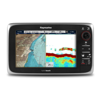
258NewaSeries/NewcSeries/NeweSeries
 Loading...