8.4Navigation
Navigatingtothecursor'slocation
InCursormodeyoucansettheChartapplicationtoguideyou
tothecursor’slocation.
1.UsetheJoysticktomovethecursortothedesiredlocation.
2.PresstheOKbutton.
Thecontextmenuisdisplayed.
3.SelectGotoCursor.
Navigatingtoawaypoint
YoucansettheChartapplicationtoguideyoutoawaypoint.
1.UsetheJoysticktohighlightawaypoint.
2.PresstheOKbutton.
ThecontextmenuisdisplayedandGotowaypointis
highlighted
3.PresstheOKbutton.
Navigatingtoawaypointfromthewaypoints
list
FromtheChartapplication:
1.Ifrequired,presstheBackbuttontoentermotionmode.
2.PresstheOKbuttontoopenthemenu.
3.SelectWaypoints.
TheWaypointslistisdisplayed.
4.Selectthewaypointyouwanttonavigateto.
TheWaypointinformationpageisdisplayed.
5.SelectGoto.
Cancellingnavigationtoawaypoint
1.Selectanypositionanywhereon-screen.
Thewaypointcontextmenuisdisplayed.
2.SelectStopGoto.
3.Alternatively,inthechartapplication,goto:Menu>Navigate
>StopGoto.
Note:Oncenavigationisnolongeractive,thewaypoint
symbolreturnstoitsnormalstate,andthedashedline
betweenyourvesselandthewaypointisremoved.
Arrivingatawaypoint
Asyourvesselapproachesthetargetwaypoint,thewaypoint
arrivalalarmprovidesawarning.
1.SelectOkonthewaypointarrivalalarmpopupmessage.
Note:Youcansettheapproachdistance(radius)atwhich
thewaypointarrivalalarmwillsoundusingtheAlarmsmenu
fromtheT ools&Settingspage:Tools&Settings>Alarms>
WaypointArrival.
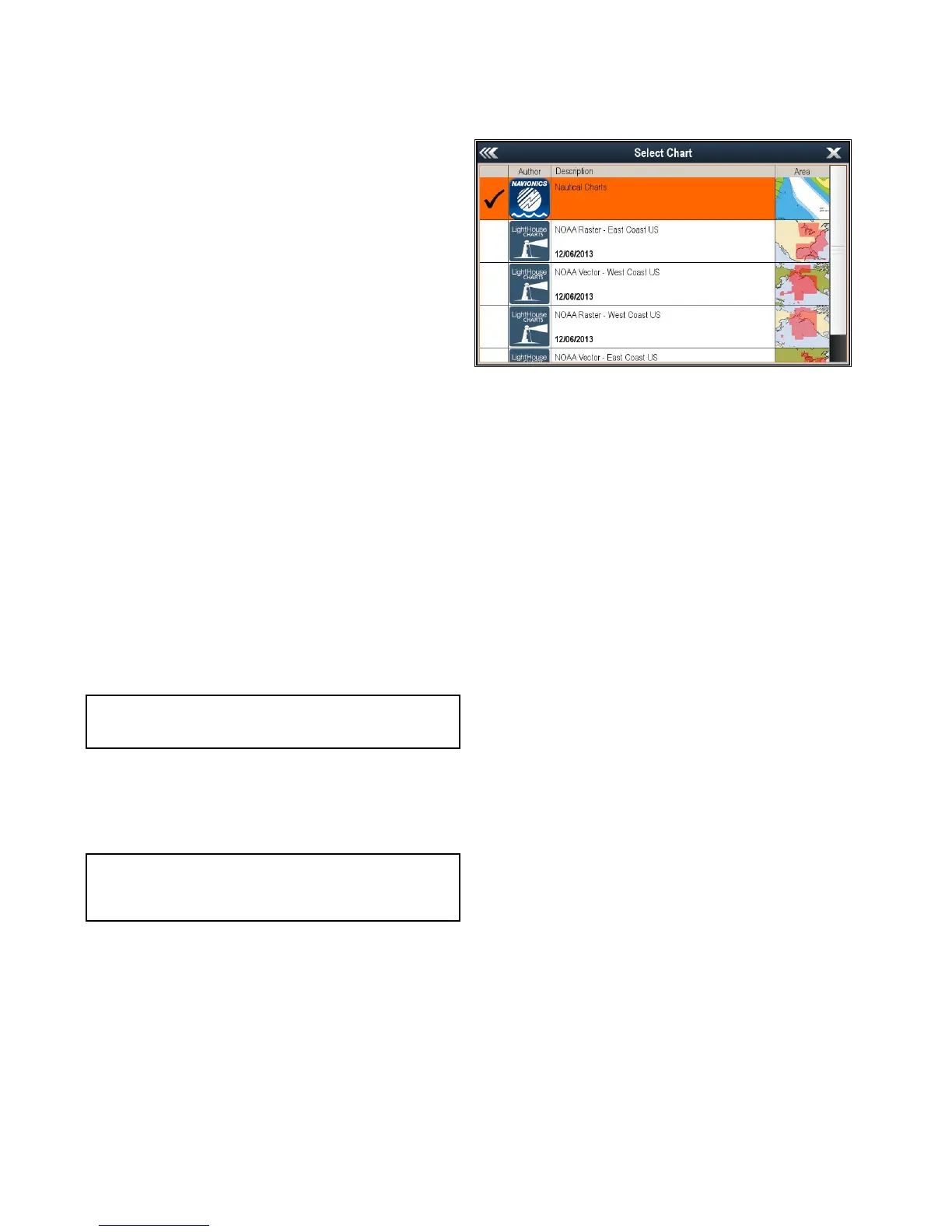
8.5Chartselection
YoucanselectthecartographytypetobeusedintheChart
application.TheChartselectionappliestotheactiveChart
instance.Youmusthavethenecessarycartographychart
cardsinsertedintoyourmultifunctiondisplayinordertodisplay
differentcartographytype.
SelectingtheCartographytype
Youcanselectthecartographytypeyouwanttodisplayinthe
Chartapplication.
Ensureyouhaveinsertedthechartcardthatcontainsthe
cartographytypeyouwanttodisplay.
FromtheChartapplicationmenu:
1.SelectChartSettings.
2.SelectChartSelection.
Alistofavailablecartographyisdisplayed.
3.Selectthecartographytypeyouwanttodisplay
TheChartwindowisre-drawntoshowtheselectcartography
type.
52
Dragony/Dragony7
 Loading...