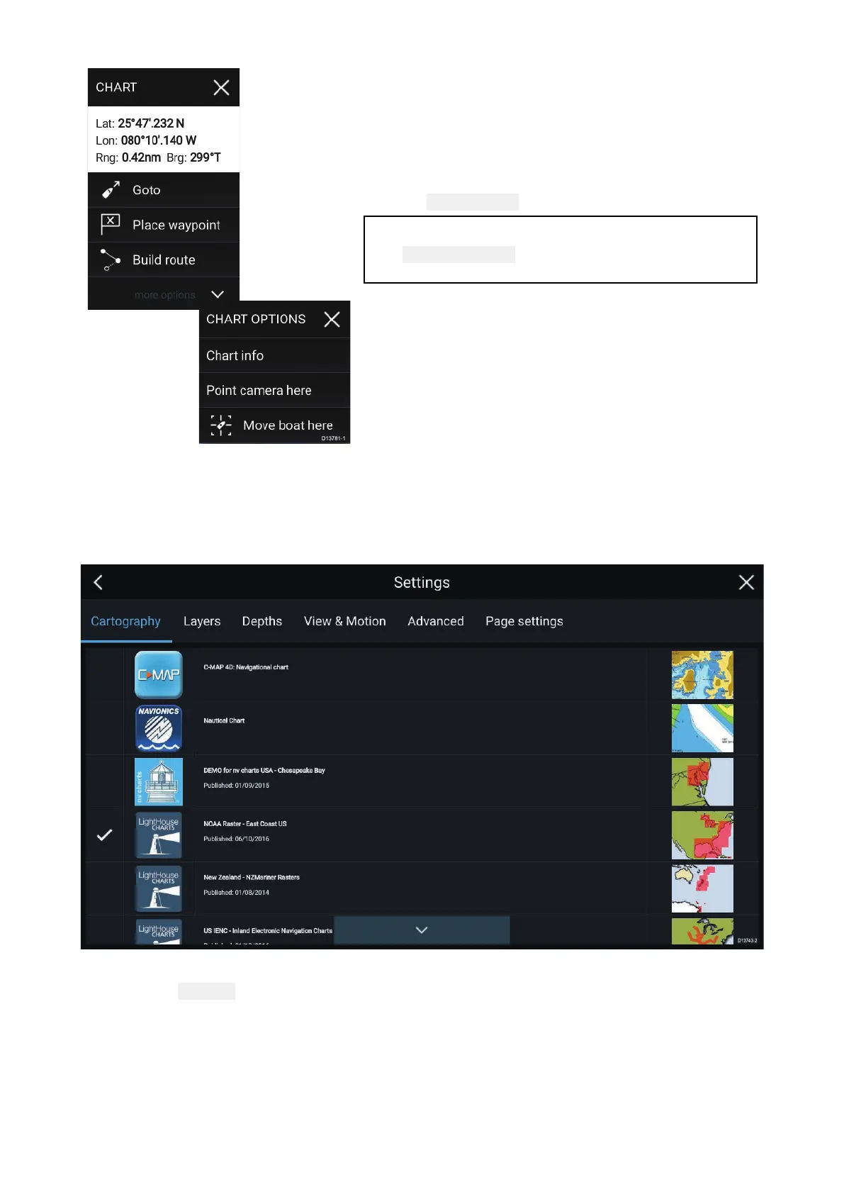
•Conte
xtmenusareaccessedintheChartappby
pressingandholdingonalocationorobject.
•ThecontextmenuprovidesLatitude,longitude,range
andbearingdetailsfortheselectedlocationorobject.
•Thecontextmenuprovidesquickaccesstorelevant
settingsorfeatures.
•Select
Moreoptionstodisplayfurtheroptions.
Note:
The
Moveboathereoptionisonlyavailablein
Demo/simulatormode.
Selectingachartcard
Y oucanuseLightHouse™chartsandcompatibleNavionicsandC-MAPelectroniccharts.The
electronicchartcardsmustbeinsertedintotheMFD’sMicroSDcardreader(orthecardreaderofan
MFDonthesamenetwork).
FromtheChartappmenu:
1.Selectthe Settingsicon.
2.SelectthecartographythatyouwanttousefromtheCartographytab.
Y oumaychooseadifferentchartforeachinstanceoftheChartapp,accessedfromtheHomescreen.
Cartographyselectionwillpersistuntilchanged.
76
 Loading...