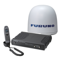
10.2 Status monitor
10-8
4. Antenna elevation
This shows the Antenna elevation angle. It is not the mechanical elevation angle, but the
elevation angle detected by the Antenna unit.
5. Signal strength
This shows the Signal strength (C/No). Antenna bar display is made based on this data,
too. When no communication is made, Regional Beam is being received in normal cases,
and when communication has started, Spot Beam will be used and therefore the Signal
strength level will increase.
For example, in the case of FELCOM-500, when no communication is made, the Signal
strength is 62 dB/Hz, and when communication is made, the Signal strength is 68
dB/Hz. When the Signal strength gets as low as 50 dB/Hz or lower, in other words,
when signal is blocked, the system switches to search mode by switching the channel,
satellite, and EL.
As for the contrast between the Signal strength and the Antenna bar display, refer to
page 10-3.
Reference)
The rough standard for FELCOM-500 for when no communication is made is
“approx. 60”, and when communication is made, it will rise to “approx. 70”.
In the case of FELCOM-250, the rough standard will rise from “approx. 55” to
“approx. 65”. Please note that the values may vary according to the antenna
variation, the satellite used, and the position.
10.2.3 Ship position information
1. Using GPS
This shows which GPS data – Internal GPS or External GPS – is being used by the
system.
Switching between Internal GPS and External GPS is executed automatically, and
Internal GPS is prioritized between the two.
Relevant settings)
By following Settings -> Basic settings -> GPS, you can make the settings for the
Baud rate of the External GPS and also monitor the GPS data.
2. Latitude
The latitude is displayed.
The priority order between the sentences is; GNS > GGA > RMC > GLL.
3. Longitude
The longitude is displayed.
The priority order between the sentences is; GNS > GGA > RMC > GLL.
 Loading...