Garmin aera 500 Series Pilot’s Guide
190-01117-02 Rev. C
88
Hazard Avoidance
OverviewGPS NavigationFlight PlanningHazard AvoidanceAdditional FeaturesAppendicesIndex
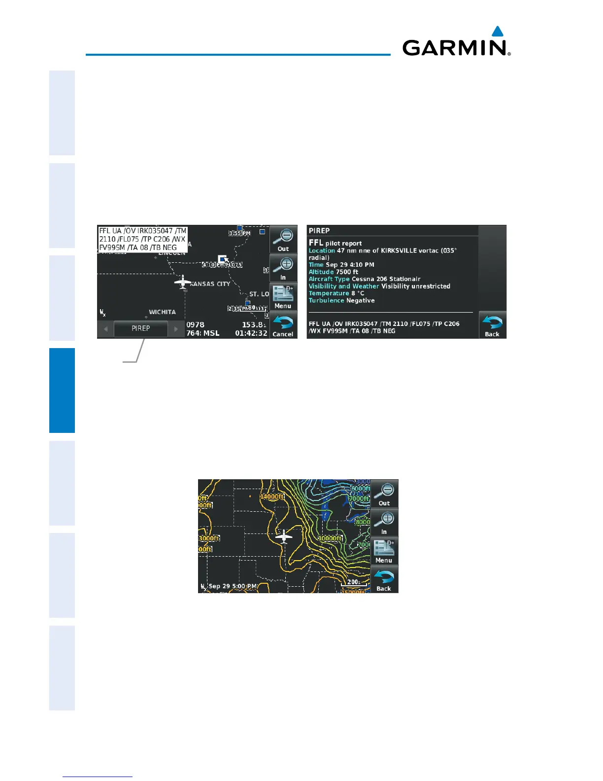
PIREPS
Pilot Weather Reports (PIREPs) provide timely weather information for a particular
route of flight. When significant weather conditions are reported or forecast, Air Traffic
Control (ATC) facilities are required to solicit PIREPs. A PIREP may contain unforecast
adverse weather conditions, such as low in-flight visibility, icing conditions, wind shear,
and turbulence. PIREPs are issued as either Routine (UA) (blue) or Urgent (UUA)
(yellow).
PIREP Selected Additional PIREP Data
Map
Feature
Button
FREEZING LEVELS
Freezing Level shows contours for the lowest forecast altitude where icing conditions
are likely to occur.
Freezing Level Data

 Loading...