Garmin aera 500 Series Pilot’s Guide
190-01117-02 Rev. C
22
Overview
OverviewGPS NavigationFlight PlanningHazard AvoidanceAdditional FeaturesAppendicesIndex
➌
T
ouch the Map Feature Button to review information for the Map Feature.
➍
T
ouch the Back Icon to return to the map or touch and hold the Menu/
Icon to navigate to the map feature. Touch the Cancel Icon to remove the
map pointer.
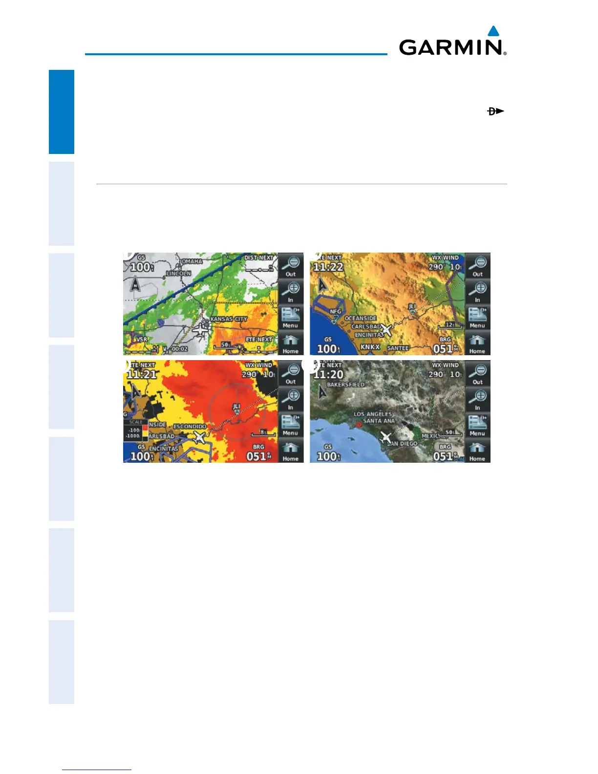
MAP OVERLAYS
The
➊
Weather,
➋
Topography,
➌
Terrain, and
➍
Satellite Imagery map overlays
can be displayed or removed.
➋
➌
➊
➍
Displaying/removing map overlays:
1)
From the 'Home' Screen, touch Map > Menu > Show/Hide.
2)
Touch the 'Show/Hide' Data Option Button for the desired overlay.
Satellite View only displays satellite imagery at and above the 20nm range. Below
the 20nm range, 'no sat view' is displayed below the map range.

 Loading...