Garmin aera 500 Series Pilot’s Guide
190-01117-02 Rev. C
118
Hazard Avoidance
OverviewGPS NavigationFlight PlanningHazard AvoidanceAdditional FeaturesAppendicesIndex
SYSTEM STATUS
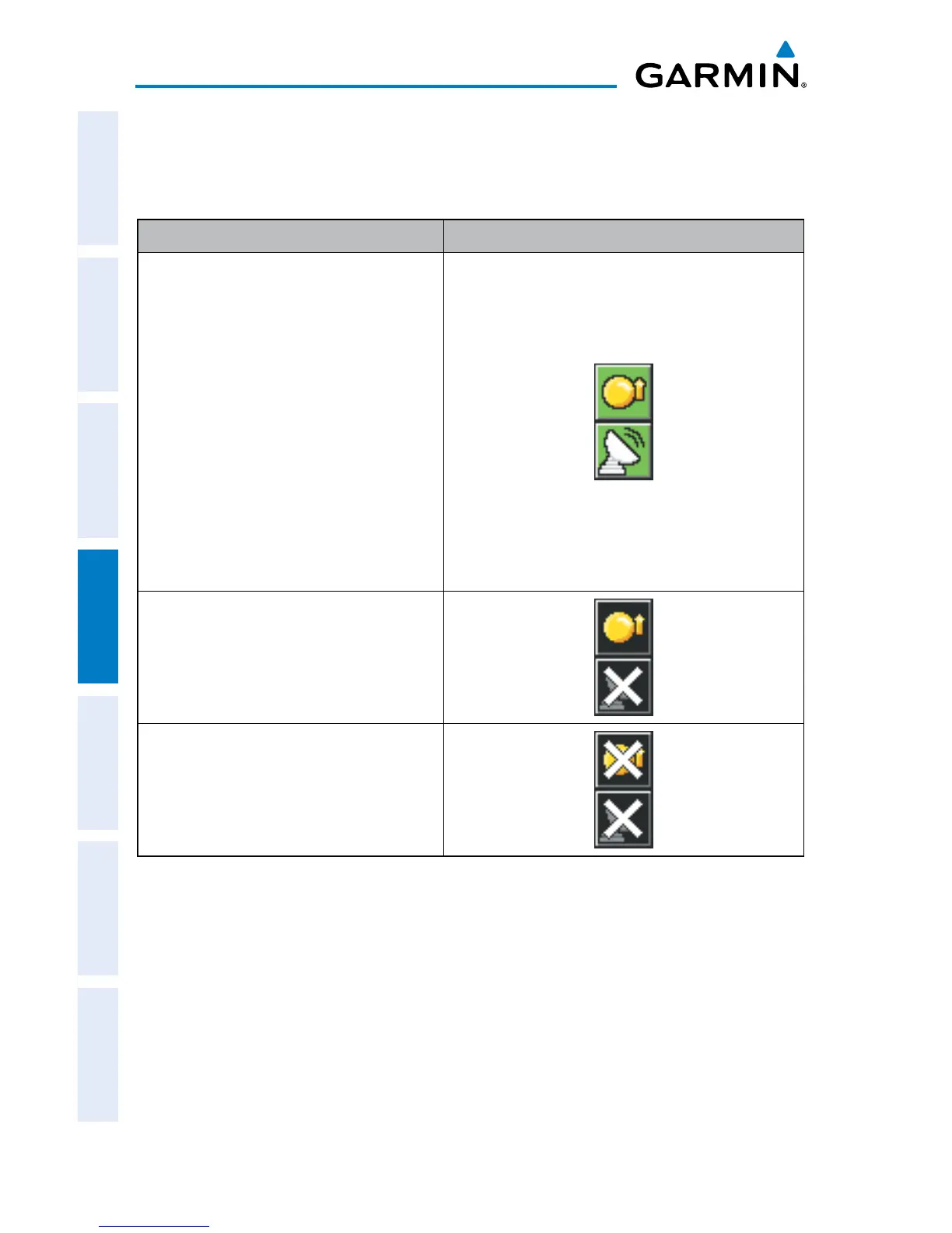
The traffic system status is annunciated in the upper right corner of the Map Page,
as well as the bottom of the dedicated Traffic Page.
System Status Traffic Icon
Full traffic services available for an
ADS-B participating aircraft (ground
linked TIS-B, FIS-B and ADS-R, and
Air-to-Air ADS-B). If you are using
the GDL 39 on a non-participating
aircraft you may still see this when
you are within the service area of
any participating aircraft. As a non-
participating aircraft you are only
receiving TIS-B traffic information for
traffic within 15 nm and 3,500’ of the
participating aircraft.
Limited traffic services available (may
be limited to Air-to-Air ADS-B)
No Traffic Data Available
Traffic Modes
The GDL 39 also has a pressure altitude sensor to aid in displaying the relative
altitude of received traffic information. If the GDL 39 is used onboard a pressurized
aircraft, the pressure altitude sensor should be turned off.
Configuring the GDL 39 for a Pressurized or Non-Pressurized
Aircraft:
1)
From the Main Menu touch the Tools Icon.
2)
From the Tools menu touch Data Link.

 Loading...