12
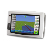
Leica mojo3D, System Overview
1 System Overview
The images in this manual are for reference purposes only. Individual screens and
icons may differ from the actual items.
1.1 General mojo3D System Information
General informa-
tion
• Leica Geosystems' mojo3D is a GPS-based agricultural guidance system that
provides visual guidance and mapping with optional auto steering and section
control.
• Beyond its capabilities of visual or auto steer guidance and section control the
mojo3D also provides remote service and diagnostics and remote upgrades via
Virtual Wrench, thus reducing costly on-site service calls.
 Loading...