17.1Waypointsoverview
Waypointsarepositionmarkersusedforthe
purposesofnavigation.Yourmultifunctiondisplay
cancreatewaypoints,whichcanthenbeselected
foractivenavigation.
Therearearangeoffeaturesforplacing,navigating
andmanagingwaypoints,thesecanbeaccessed
fromtheWaypointsmenuandWaypointcontext
menu.Waypointsarerepresentedon-screenusing
customizablewaypointsymbols.Waypointcanbe
created,moved,deleted,exportedtomemorycard
orimportedfromamemorycard.
Waypointdisplayexamples
Waypointsinthechartapplication
Inthechartapplicationbothactiveandinactive
waypointsareshown.Anactivewaypointistheone
thatyouarenavigatingto.
ItemDescription
1Inactivewaypoint
2Activewaypoint
3Alternativewaypointsymbols
Thedefaultwaypointsymbolisared‘X’.Alternative
symbolscanbeusedifrequired.
Waypointsintheradarapplication
Intheradarapplicationbothactiveandinactive
waypointsareshown.Anactivewaypointistheone
thatyouarenavigatingto.
1.Inactivewaypoint
2.Activewaypoint
3.Alternatewaypointsymbols
Thedefaultwaypointsymbolisared‘X’.Alternative
symbolscanbeusedifrequired.
Waypointsintheshnderapplication
Waypointsintheshnderapplicationare
representedbyaverticallinelabelledWPT .
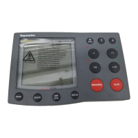
Waypoint(MOB)button/icon
Dependingonthemultifunctiondisplayvariant
therewillbeeitheraWaypoint(MOB)buttonoran
on-screenicon.
WPT
button
•cSeries
•eSeries
•RMK-9keypad
WPT
icons
•aSeries
•gSSeries
Throughoutthismanualtheterm:SelectWPT,refers
topressingthephysicalWPTbuttonorpressingthe
on-screenWPTicon.
Waypointcontextmenu
Placingthecursoroverawaypointinthechartor
radarapplicationsdisplaysacontextmenushowing
thewaypoint'spositionaldataandmenuitems.
Thecontextmenuprovidesthefollowingpositional
dataforthewaypointinrelationtoyourvessel:
•Latitude
•Longitude
•Range
•Bearing
Forinactivewaypointsthefollowingmenuitemsare
available:
208aSeries/cSeries/eSeries
 Loading...