10
.6Rangeandbearing
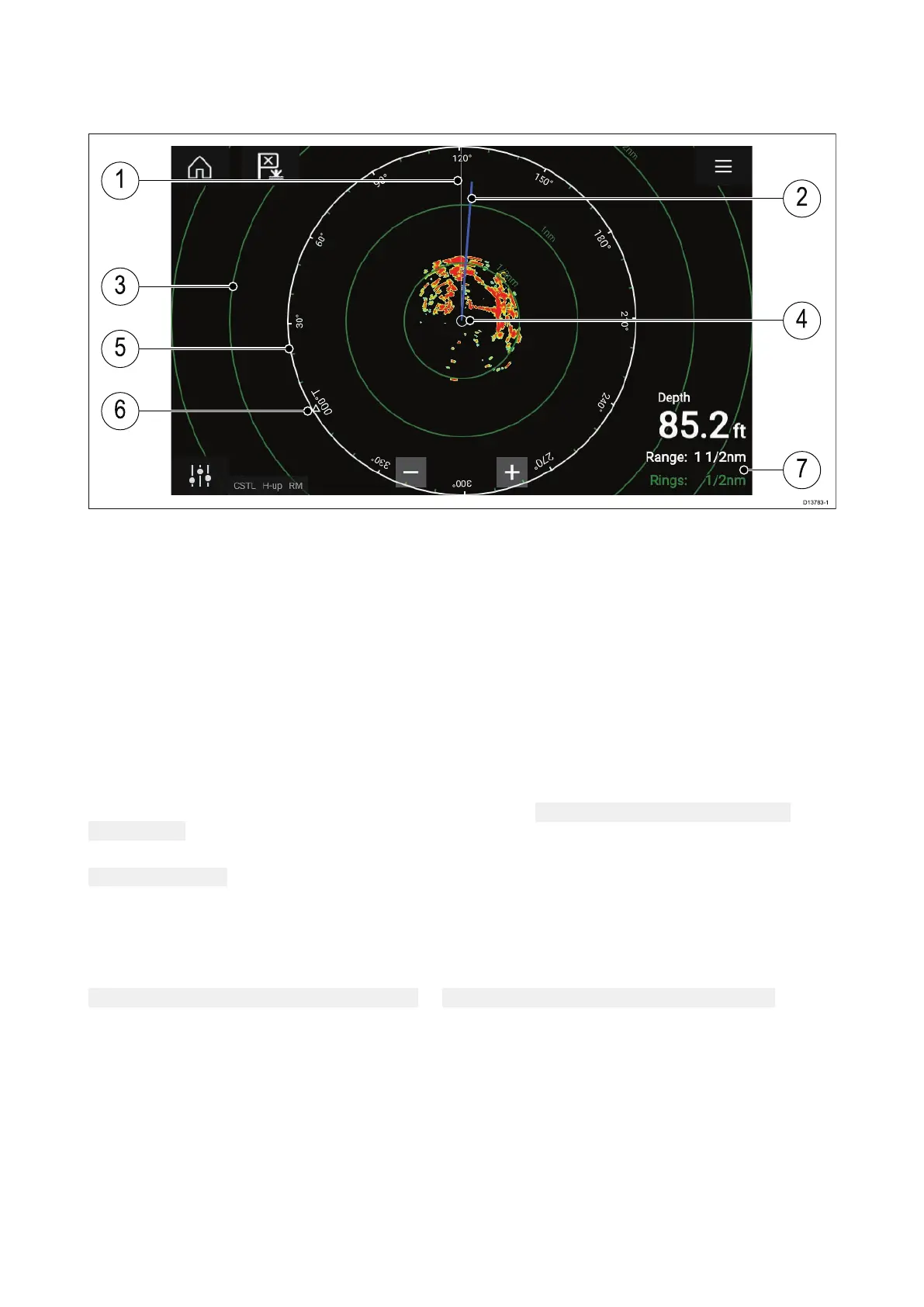
TheRadarapphelpsyouidentifyatarget’srange(distance)andbearingfromyourvessel.
1.SHM(Shipsheadingmark er).
2.COG/SOGline(Pointsinthedirectionoftravel(COG),withthelengthofthevectorprovidingan
indicationofspeed(SOG)).
3.Rangerings.
4.Vesselposition.
5.Rangeandbearingindicator(TheWhiteringidentifiesthedistancefromyourvesseltothetop
edgeofthescreen.Bearingindicatorsarealsoprovidedaroundthering).
6.Northindicator(AlwayspointsNorth).
7.CurrentdisplayedRangeandRingseparationdistance(Range:identifiesthedistancefromyour
vesseltothetopedgeofthescreen.Rings:identifiesthedistancebetweeneachRangeRing).
ThedisplayedrangecanbeadjustedatanytimeusingtheRangecontrols.
RangeringscanbeswitchedofffromthePresentationtab:
Menu>Settings>Presentation>
R angerings:
Y oucanalsochoosewhethertodisplayanumericalrangeindicatoragainsteachringusingthe
R angeringlabels:option.
VRM(VariableRangeMarker)/EBL(ElectronicBearingLine)
VRM/EBLisusedtodetermineatargetsrangeandbearingfromyourvessel,orfromanothertarget.
2VRM/EBLsareavailablewhichareenabledfromthecontextmenu.
Conte xtmenu>Moreoptions>VRM/EBL1or Contextmenu>Moreoptions>VRM/EBL2
R adarapplication
119
 Loading...