5
GPS OPERATION
5-14
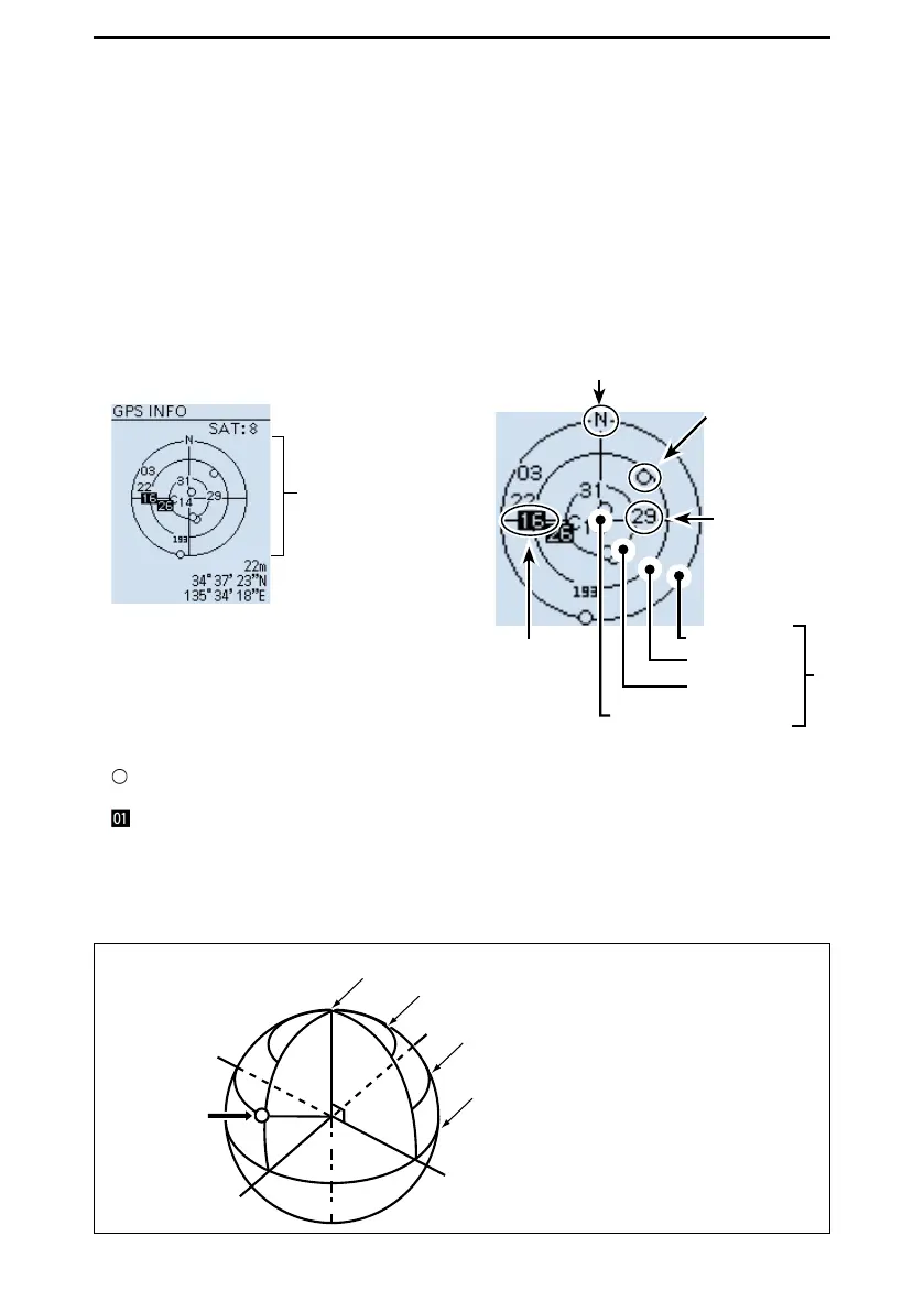
■ Checking GPS information (Sky view screen)
This screen is used to view GPS satellite information .
The GPS Information displays the quantity, signal power, and position of the GPS satellites.
The sky view screen displays the position of GPS satellites. The screen also displays the
direction, elevation angle, satellite numbers, and their receiving signal strength status.
1. Push [QUICK].
2. Select “GPS Information.” (Rotate [DIAL] to select it, then push [ENTER].)
• Displays the “GPS INFO” screen.
L Push [CLEAR] to return to the Main screen.
North
Untracking
satellite
Satellite
number 29’s
signal is weak.
0 degree line
30 degree line
60 degree line
90 degree line (Zenith)
Satellite number
16’s signal is
strong.
Meaning of each icon
• ( ): Untracking satellite.
• (01): Tracking satellite with a weak signal, shown by the satellite number.
• (
): Tracking satellite with a strong signal, shown by the satellite number.
• (SAT): The quantity of tracking satellites.
• Altitude: The altitude of your station.
The altitude is displayed only when 4 or more satellites are tracked. When 3 or less
satellites are tracked, “------ft” is displayed.
• Longitude/Latitude: Longitude and Latitude of your location.
N
W
E
S
Elevation angle 0 degree line
Elevation angle 30 degree line
Elevation angle 60 degree line
Elevation angle 90 degree line (Zenith)
Satellite
number 16
The image of satellite number 16
GPS information screen
←Latitude
←Altitude
Sky view screen
←Longitude
← Tracking
satellite quantity
Elevation angle
 Loading...