14.3GPSCheck
CheckingGPSoperation
YoucancheckthattheGPSisfunctioningcorrectly
usingthechartapplication.
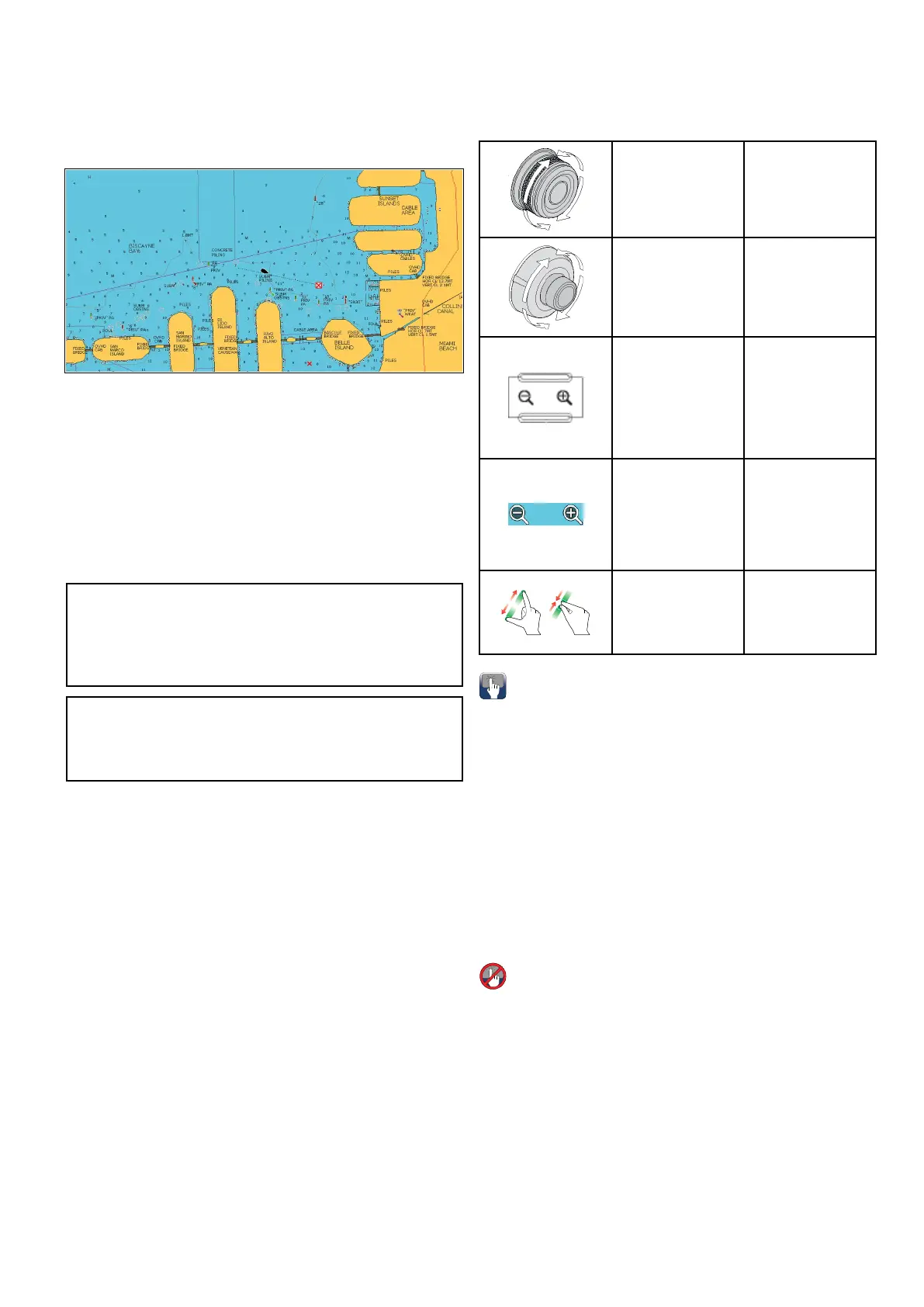
1.SelecttheChartpage.
2.Checkthescreen.
Withthechartdisplayed,youshouldsee:
Yourboatposition(indicatesaGPSx).Your
currentpositionisrepresentedbyaboatsymbol
orsolidcircle.Yourpositionisalsodisplayedin
thedatabarunderVESPOS.
Asolidcircleonthechartindicatesthatneither
headingnorCourseOverGround(COG)data
isavailable.
Note:Raymarinerecommendsthatyoucheckthe
displayedvesselpositioninthechartapplication
againstyouractualproximitytoaknowncharted
object.GPSreceiverstypicallyhaveanaccuracy
ofbetween5and15m.
Note:AGPSStatusscreenisavailablewithinthe
SetupmenuofRaymarinemultifunctiondisplays.
Thisprovidessatellitesignalstrengthandother
relevantinformation.
14.4Chartrangingandpanning
Ranginginandout
ThetablebelowshowstheRangecontrolsavailable
foreachdisplayvariant.
RotaryControl•eSSeries
RotaryControl•cSeries
•eSeries
•RMK-9keypad
Rangeinand
Rangeoutbuttons
•cSeries
•eSeries
(excludinge7
ande7D
•RMK-9keypad
Rangeinand
Rangeout
onscreenicons
•aSeries
•eSeries
•gSSeries
•eSSeries
Multi-Touch
gesture—Pinch
toZoom
•aSeries
•gSSeries
•eSSeries
Panningthechart
Youcanpanthechartareaonatouchscreen
multifunctiondisplaybyfollowingthestepsbelow.
Inthechartapplication:
1.Swipeyourngeracrossthescreenfromright
tolefttopanright.
2.Swipeyourngeracrossthescreenfromleftto
righttopanleft.
3.Swipeyourngeracrossthescreenfromtopto
bottomtopanup.
4.Swipeyourngeracrossthescreenfrombottom
totoptopandown.
Panningthechart
Youcanpanthechartareaonanon-touchscreen
multifunctiondisplaybyfollowingthestepsbelow.
Fromthechartapplication:
1.MovetheJoystickinthedirectionyouwantto
pan.
Chartapplication
169
 Loading...