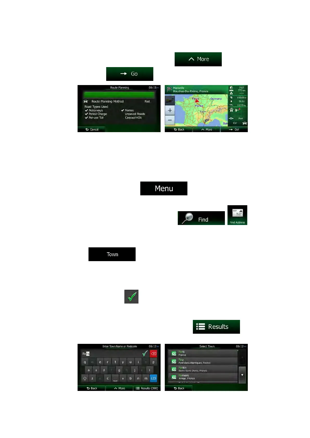
7. After a short summary of the route parameters, the map appears showing the entire
route. The route is automatically calculated. Tap
to modify route
parameters, or tap
and start your journey.
3.1.2.4 Selecting a city/town centre as the destination
The city/town centre is not the geometric centre of the city/town but an arbitrary point the map
creators have chosen. In towns and villages, it is usually the most important intersection; in
larger cities, it is one of the important intersections.
1. If you are on the Map screen, tap
to return to the Navigation
menu.
2. In the Navigation menu, tap the following buttons:
, .
3. If necessary, modify the country as described earlier (page 34).
4. Select the destination city/town:
a. Tap
.
b. Start entering the name of the city/town on the keyboard.
c. Find the city/town you need:
• The most likely city/town name is always shown in the input field. To
accept it, tap
.
• If the desired name does not show up, the names that match the string
appear in a list after entering a couple of characters (to open the list of
results before it appears automatically, tap
). Select
the city/town from the list.
NX505E English 39
 Loading...