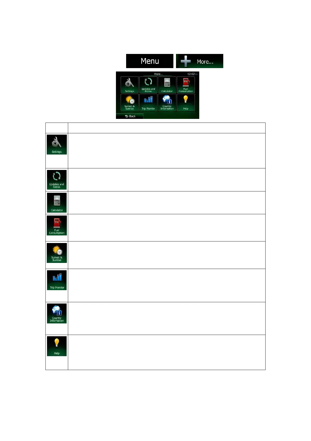
5.2 'More' menu
The 'More' menu provides you with various options and additional applications. On the map
screen, tap the following buttons:
, .
You can configure the program settings, and modify the behaviour of Clarion Mobile
Map. Fine-tune route planning options, change the look of the Map s
or off warnings, or restart the Configuration wizard, and so on.
See the next chapter for details.
Visit www.naviextras.com to get additional content, such as new maps or 3D
landmarks and useful applications..
The scientific calculator helps you in all your calculation needs. Tap the Mode
button for additional functions and use the memory to save your results.
The Fuel consumption monitor helps you keep track of the consumption of your car
even if you do not use navigation for all your journeys. Set the initial odometer value
and then record the distance taken and fuel filled in whenever you fill your car. You
can also set reminders for regular car maintenance.
Tap this button to see the sunlit and dark areas of the world. Your current location
and route points are marked on the map. Tap the Details button to see the exact
sunrise and sunset times for all your route points (your current location, all
waypoints and the final destination).
If you save your trip logs when you arrive at some of your destinations or let the
application automatically save the trip logs for you, those logs are all listed here.
Tap one of the trips to see the trip statistics, speed and altitude profile. If track log
has also been saved, you can display it on the map with the selected colour. Track
logs can be exported to GPX files for later use.
Select a country from the list and see useful dr
iving information about the selected
country. Information may include speed limits on different road types, the maximum
blood alcohol level and any compulsory equipment you need to show when stopped
by the police.
Run the Demo and watch sample route simulations to see how navigation works.
The About section provides you with product information. Read the Software and
Database End User License Agreement, or check the map and other contents of the
application. You can also access program usage statistics.
84 NX505E English
 Loading...