EasyManuals Logo
Home>Clarion>Car Video System>NX505E

Clarion NX505E User Manual

Clarion NX505E
164 pages
To Next Page IconTo Next Page
To Previous Page IconTo Previous Page
Page #88 background imageLoading...
Page #88 background image
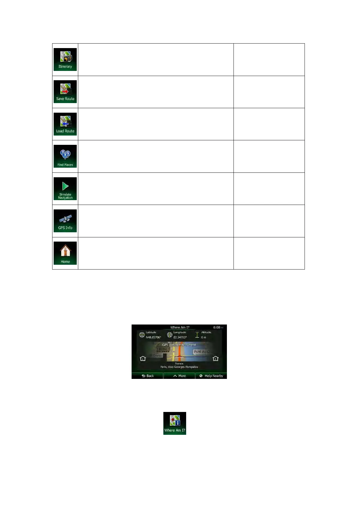
This button opens the list of manoeuvres (the itinerary).
Tap the top of the Map
screen during navigation.
With this function you can save the active route for later
use.
My Route / More / Save
Route
With this function you can replace the active route with a
previously saved route.
My Route / More / Load
Route
With this function you can search for Places of Interest in
various different ways.
Find / Find Places (page
43)
This button opens the Map screen and starts simulating
the active route.
My Route / More /
Simulate Navigation
(page
75)
This button opens the GPS Information screen with
satellite position and signal strength information.
Tap the top of the Map
screen when there is no
GPS reception
This button offers your Home location as a destination.
2.3.6 Checking the details of the current position (Where Am I?)
This screen contains information about the current position (or about the last known position if
GPS reception is not available) and a button to search for useful Places nearby.
You can access this screen from the map in one of the following ways:
• If the current street is displayed below the Vehimarker (the current position on the
map), tap it to open the Where Am I? screen.
• Open the Quick menu and tap the
button.
Information on this screen:
NX505E English 23

Table of Contents

Questions and Answers:

Question and Answer IconNeed help?

Do you have a question about the Clarion NX505E and is the answer not in the manual?

Clarion NX505E Specifications

General IconGeneral
Widescreen-
Display diagonal6.2 \
Display resolution800 x 480 pixels
AM band range531 - 1602 kHz
FM band range87.5 - 108 MHz
Supported radio bandsAM, DAB, FM
Built-in cameraNo
Lifetime map updatesRoads change, but with Lifetime Map Updates your map will always be up to date. Start fresh every few months by downloading a new edition of the industry's most accurate map. New editions are issued four times per year.
Storage media typeMemory card
Compatible memory cardsMicroSD (TransFlash)
Product colorBlack
Weight and Dimensions IconWeight and Dimensions
Depth157 mm
Width178 mm
Height100 mm
Weight- g

Related product manuals