Gives a quick but fuel efficient route based on the fuel cons
data given in Route settings (page 88). Travel cost and CO
2
calculations are estimations only. They cannot take elevations, curves
and traffic conditions into account.
For vehicle types where Green routing is not available, this method
combines the benefits of Fast and Short: Clarion Mobile Map calculates
as if it were calculating the Fast route,
but it takes other roads as well to
save fuel.
Results in a route with fewer turns and no difficult manoeuvres. With
this option, you can make Clarion Mobile Ma
p to take, for example, the
motorway instead of a series of smaller roads or streets.
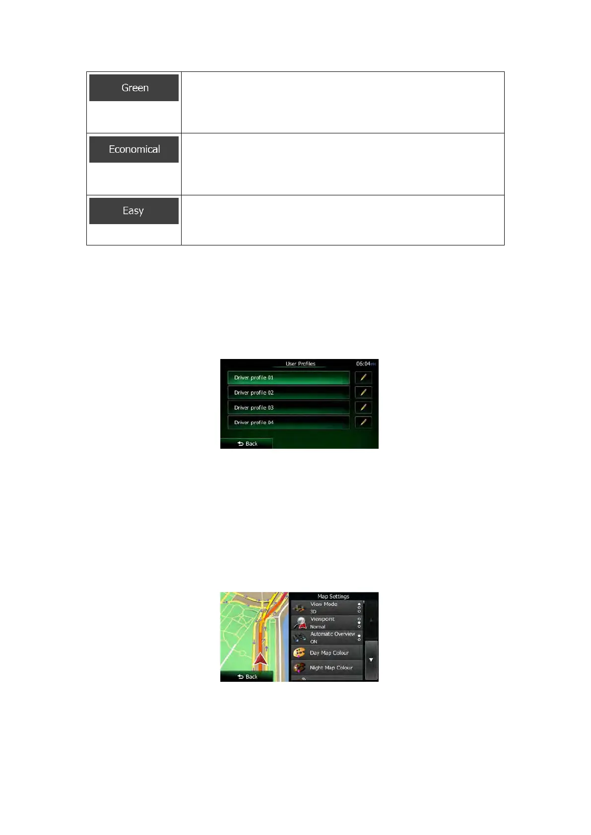
5.3.5 User profiles
If more drivers use Clarion Mobile Mapfor navigating, their settings can be remembered by
using one of the user profiles. Rename the profiles after tapping the edit button on the right so
that all users know which profile to use and switch between profiles by tapping its name. If
you select a new profile, the application restarts so that the new settings can take effect.
5.3.6 Map settings
You can fine-tune the appearance of the Map screen. Adjust the map view to your needs,
choose suitable colour themes from the list for both daytime and night use, change the blue
arrow to a 3D car model, show or hide 3D buildings, turn track logging on or off, and manage
you Place visibility sets (which Places to show on the map).
The map is always shown on the screen so that you can see the effect when you change a
setting.
NX505E English 91
 Loading...