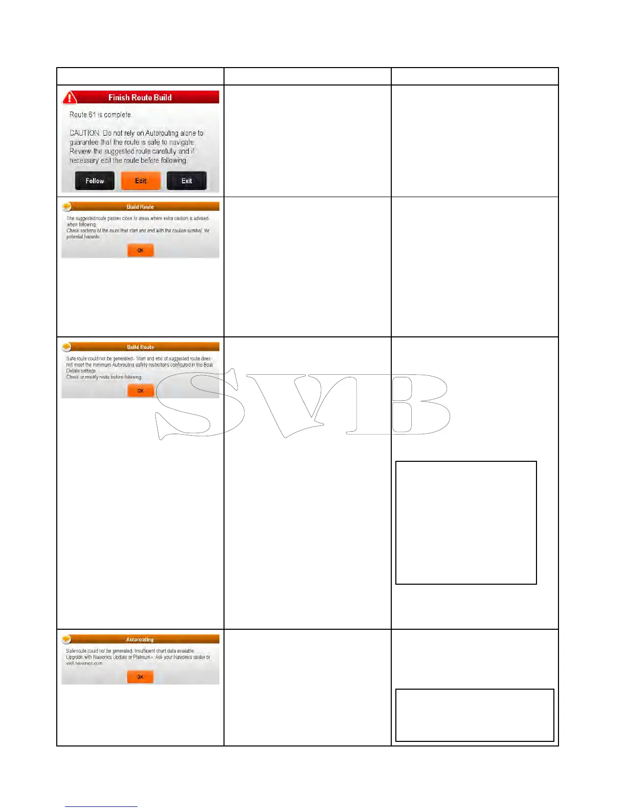
30.5TroubleshootingAutorouting
TheinformationbelowdetailsthewarningsthatcanbedisplayedwhenusingAutorouting,adescriptionof
whatthewarningmeansandactionstobetakentocorrecttheissue.
WarningmessageDescriptionResolution
AutoroutinghascompletedsuccessfullyTheRoutemaybefollowedAFTERit
hasbeenreviewedtoensurethatthe
generatedrouteissafeforyourvessel
tofollow.
Autoroutinghascompletedsuccessfully,
howevertheroutepassesclosetoareas
whereextracautionisadvised(e.g.a
chartedbuoy).
Thecautionareaswillbebetween
waypointsthathavebeenassigned
cautionsymbol.
Theroutemustbereviewedasfollows:
•Identifyanywaypointsusingthe
cautionsymbol(thesewillbeinsetsof
2),checkbetweenthecautionsymbols
toidentifythereasonforthecaution.
•Ifpossiblemovethewaypoint(s)to
avoidthehazard.
•Reviewallroutelegsandtheir
waypointstoensureappropriate
beforefollowingtheroute.
Thestartandorendpointoftheroute
doesnotmeettheminimumsafevalues
speciedintheBoatDetailssettings.
Thestartandendwaypointswillbe
createdandjoinedwithastraight
routeleg,howevertherewillbeno
automaticallygeneratedwaypointsand
thewaypointsymbolswillbechangedto
cautionsymbols.
Performthefollowingchecks:
•Checkthatthevaluesspeciedinthe
BoatDetailssettingsarecorrect.
•Usingthecontextmenucheckthe
ChartObjectsmenuattheexact
locationofthestartandorendpoints
toestablishiftheDepthrangemin
valuemeetsyouMinimumSafe
Depth.
Note:
–Ifnominimumvaluefordepthis
availableatthedesiredlocation
Autoroutingwillassumea
minimumdepthof0feet.
–Autoroutingaddsitsown
safetymarginof0.8mor20%
ofthespeciedMinimumSafe
Depthwhicheverisgreater.
•Checkforanyotherhazardsthat
wouldpreventAutoroutingfrom
generatingaroute.
Thereisinsufcientdataavailableonthe
cartographytogeneratetheroute,
Thestartandendwaypointswillbe
created,howevertherewillbeno
automaticallygeneratedwaypointsand
thewaypointsymbolswillbechangedto
cautionsymbols.
•Insertcompatiblecartography
(Navionics®UpdatesorNavionics®
Platinum
TM
+)
•Updateexistingcartography
Note:Theremaybecertainareas
wheresufcientdetailsarenot
yetavailableevenonthelatest
cartography.
408aSeries/cSeries/eSeries

 Loading...


