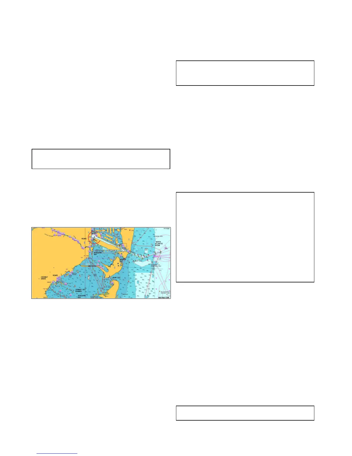
15.1Chartapplicationoverview
Thechartapplicationprovidesanelectronicchartwithpassage
planningandnavigationfeatures.Itcombines2Dand3D
viewpointsandprovidesavarietyofcartographicinformation
regardingyoursurroundingsandchartedobjects.
Typicalusesforthechartapplicationinclude:
•Monitoryourvessellocationandheading.
•Interpretyoursurroundings.
•Measuredistanceandbearing.
•Navigateusingwaypoints.
•Plan,andNavigateusingroutes.
•Monitorxedandmovingobjectsusingradaroverlay.
•MonitorvesselsinyourvicinityusingAISdata.
•Keeptrackandrecordyourcourse.
•Viewinformationforchartedobjects.
•OverlayNOWRadweatherinformation.
•Overlayaerialphotosandotherchartenhancements
Note:Toobtainfull3Ddetail,youmusthavechartcards
containing3Dcartographyfortheappropriategeographic
area.
Youcanalsouseyourmultifunctiondisplaytocustomizeyour
chartapplicationtoyourownparticularrequirementsand
circumstances.Youcan:
•Alterthewaythechartisdrawninrelationtoyourvessel
andthedirectionyouaretravellingin(chartorientationand
motionmode).
•Manageandeditchartdatayouhaveentered.
•Controlthelevelofdetaildisplayedon-screen.
Chartdatum
Thechartdatumsettingaffectstheaccuracyofthevessel
positioninformationdisplayedinthechartapplication.
InorderforyourGPSreceiverandmultifunctiondisplayto
correlateaccuratelywithyourpapercharts,theymustbeusing
thesamedatum.
ThedefaultdatumforyourmultifunctiondisplayisWGS1984.
Ifthisisnotthedatumusedbyyourpapercharts,youcan
changethedatumusedbyyourmultifunctiondisplay,usingthe
systempreferencespage.Thesystempreferencespagecanbe
accessedfromthehomescreen:Set-up>SystemSettings>
SystemPreferences>SystemDatum.
Whenyouchangethedatumforyourmultifunctiondisplay,the
chartgridwillsubsequentlymoveaccordingtothenewdatum,
andthelatitude/longitudeofthecartographicfeatureswillalso
changeaccordingly.Yourmultifunctiondisplaywillattempttoset
upanyGPSreceivertothenewdatum,asfollows:
•IfyourmultifunctiondisplayhasabuiltinGPSreceiveritwill
automaticallycorrelateeachtimeyouchangethedatum.
•IfyouhaveaRaymarineGPSreceiverusingSeaT alkor
SeaTalk
ng
,itwillautomaticallycorrelateeachtimeyouchange
thedatumonthemultifunctiondisplay.
•IfyouhaveaRaymarineGPSreceiverusingNMEA0183,ora
third-partyGPSreceiver,youmustcorrelateitseparately.
Itmaybepossibletouseyourmultifunctiondisplaytocorrelate
anNMEA0183GPSreceiver.Fromthehomescreengoto
Set-up>Systemsettings>GPSSet-up>ViewSatellite
Status.Ifthedatumversionisdisplayed,itmaybepossible
tochangeit.FromthehomescreengotoSet-up>System
settings>DataSources>GPSDatum.
Note:Raymarinerecommendsthatyoucheckthedisplayed
vesselpositioninthechartapplicationagainstyouractual
proximitytoaknownchartedobject.AtypicalGPShasan
accuracyofbetween5and15m.
Chartcardsoverview
Chartcardsprovideadditionalcartographicinformation.
Obtaindetailedcartographicinformationfortheareathat
younavigateusingNavionics®chartcards.T ocheckthe
currentavailabilityofNavionicschartcardtypes,please
visitwww.navionics.comorwww.navionics.it.Theamountof
cartographicdetailshownvariesfordifferentareasandfor
differentscales.Thechartscaleinuseisindicatedbythe
on-screenchartscale,thenumberrepresentsthedistancethe
linerepresentsinnauticalmilesacrossthechart.
Youcanremoveandinsertchartcardswhileachartisdisplayed
providedthatyoufollowthecorrectprocedure.Thechart
informationisretainedon-screenuntilthechartapplication
redrawsthescreen;forexample,whenyoupanoutsidethe
currentarea,orusetheRangecontroltochangethechart
scale.
Caution:Careofchartandmemory
cards
Toavoidirreparabledamagetoand/orlossofdata
fromchartandmemorycards:
•Ensurethatchartandmemorycardsaretted
thecorrectwayaround.DONOTtrytoforcea
cardintoposition.
•DONOTsavedata(waypoints,routes,and
soon)toachartcard,asthechartsmaybe
overwritten.
•DONOTuseametallicinstrumentsuchasa
screwdriverorplierstoinsertorremoveachart
ormemorycard.
Chartcompatibility
Yourmultifunctiondisplayissuppliedwithabasemapand
dependingonunitaNavionicschartcard.Youmayalso
purchaseNavionicschartcardstogetenhancedchartdetails
andadditionalchartfeatures.
Yourmultifunctiondisplayiscompatiblewiththefollowing
Navionicschartcards:
•ReadytoNavigate
•Silver
•Gold
•Gold+
•Platinum
•Platinum+
•Fish'NChip
•Hotmaps
Note:RefertotheRaymarinewebsite(www.raymarine.com)
forthelatestlistofsupportedchartcards.
140NewaSeries/NewcSeries/NeweSeries

 Loading...


