190-00870-02 Rev. A
Garmin G950 Pilot’s Guide for the Pilatus PC-6
163
FLIGHT MANAGEMENT
SYSTEM
OVERVIEW
FLIGHT
INSTRUMENTS
EIS
AUDIO PANEL
& CNS
FLIGHT
MANAGEMENT
HAZARD
AVOIDANCE
AFCS
ADDITIONAL
FEATURES
APPENDICES INDEX
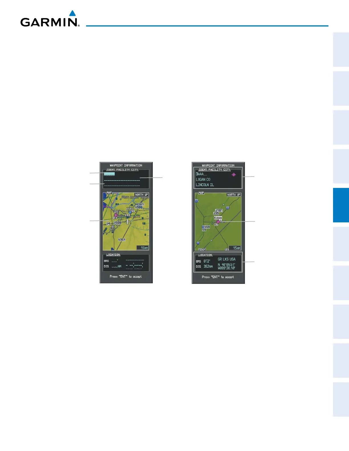
5.3 WAYPOINTS
Waypoints are predetermined geographical positions (internal database) or pilot-entered positions, and are
used for all phases of flight planning and navigation.
Communication and navigation frequencies can be tuned “automatically” from various Waypoint Information
(WPT) pages, Nearest (NRST) pages, and the Nearest Airports Window (on PFD). This auto-tuning feature
simplifies frequency entry over manual tuning. Refer to the CNS and Audio Panel section for details on auto-
tuning.
Waypoints can be selected by entering the ICAO identifier, entering the name of the facility, or by entering the
city name. See the System Overview section for detailed instructions on entering data in the G950. As a waypoint
identifier, facility name, or location is entered, the G950’s Spell’N’Find™ feature scrolls through the database,
displaying those waypoints matching the characters which have been entered to that point. A direct-to navigation
leg to the selected waypoint can be initiated by pressing the Direct-to Key on any of the waypoint pages.
Figure 5-31 Waypoint Information Window
Map Area Showing
Entered Waypoint
Identifier Entry Field
Entered Waypoint on
Map
Facility
Entry Field
City Entry Field
- Waypoint Identifier
- Type (symbol)
- Facility Name
- City
Waypoint Location
 Loading...