190-00870-02 Rev A
Garmin G950 Pilot’s Guide for the Pilatus PC-6
407
ADDITIONAL FEATURES
SYSTEM
OVERVIEW
FLIGHT
INSTRUMENTS
EIS
AUDIO PANEL
& CNS
FLIGHT
MANAGEMENT
HAZARD
AVOIDANCE
AFCS
ADDITIONAL
FEATURES
APPENDICES INDEX
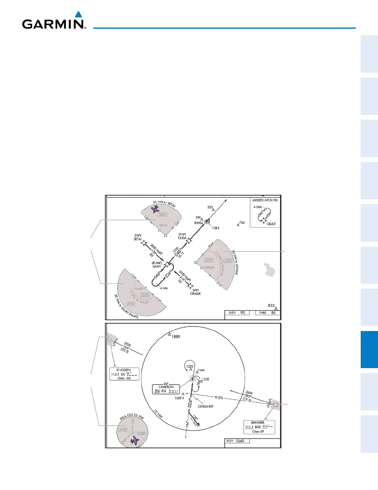
8.4 FLITECHARTS
FliteCharts resemble the paper version of AeroNav Services terminal procedures charts. The charts are displayed
with high-resolution and in color for applicable charts.
The geo-referenced aircraft position is indicated by an aircraft symbol displayed on the chart when the current
position is within the boundaries of the chart. An aircraft symbol may be displayed within an off-scale area
depicted on some charts.
Figure 8-49 shows examples of off-scale areas, indicated by the grey shading. Note, these areas are not shaded on
the published chart. These off-scale areas appear on the chart to convey supplemental information. However, the
depicted geographical position of this information, as it relates to the chart planview, is not the actual geographic
position. Therefore, when the aircraft symbol appears within one of these areas, the aircraft position indicated is
relative to the chart planview, not to the off-scale area.
The FliteCharts database subscription is available from Garmin. Available data includes:
• Arrivals (STAR)
• Departure Procedures (DP)
• Approaches
• Airport Diagrams
Figure 8-49 Sample Chart Indicating Off-Scale Areas
Off-Scale
Area
Off-Scale
Areas
Off-Scale
Area
Off-Scale
Areas
 Loading...