2. RADAR, CHART RADAR OPERATION
2-39
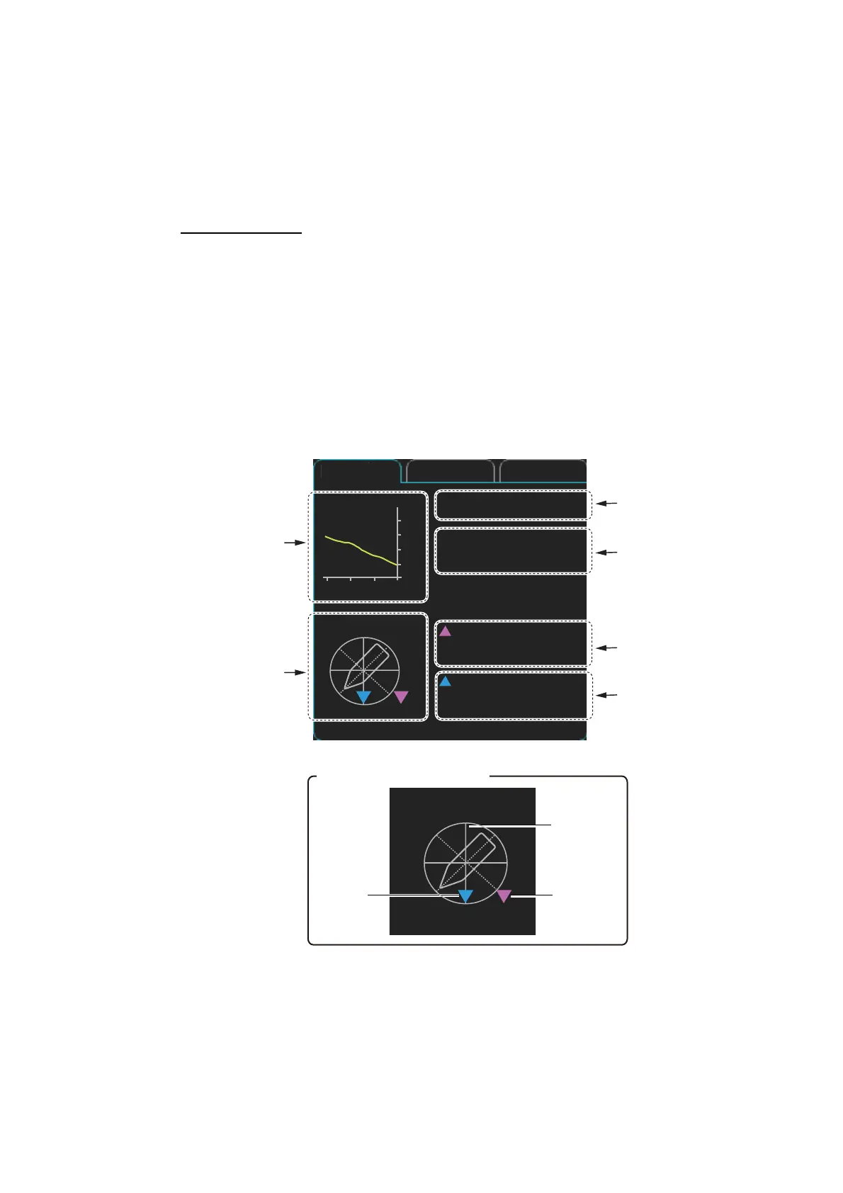
2.28 Information Box
The information box shows navigation data and, when following a route set on the
chart display, route information is also shown.
2.28.1 Information box contents
Navigation data
• Depth, analog and graph
• Current (tide) direction and speed
• Wind direction and speed
• Water temperature
• Current and wind gauge
Nav data requires appropriate navigation sensors and IEC 61162-1/2 sentences out-
put from the sensor. If there is no sentence or data input, asterisks (**) appear at the
corresponding indication.
Depth graph
Current direction
and speed
Wind direction
and speed
Current and
wind gauge
(See inset.)
Depth :
403 m
Water
TEMP :
3.7°C
Wind True-North
20.1 kn
Current
25.9 kn
NAV data
Route 1 Route 2
N
E
S
W
0
100
200
300
400
500
-30 -20 -10 min m
Depth
Water
temperature
Current and wind gauge
Heading
Wind
direction
N
E
S
W
Current
direction
124.5°
177.6°T
 Loading...