10-4
GTN 625/635/650 Pilot’s Guide
190-01004-03 Rev. P
Foreword
Getting
Started
Audio &
Xpdr Ctrl
Com/Nav
FPL
Direct-To
Proc
Wpt Info
Map
Traffic
Terrain
Weather
Nearest
Services/
Music
Utilities
System
Messages
Symbols
Appendix
Index
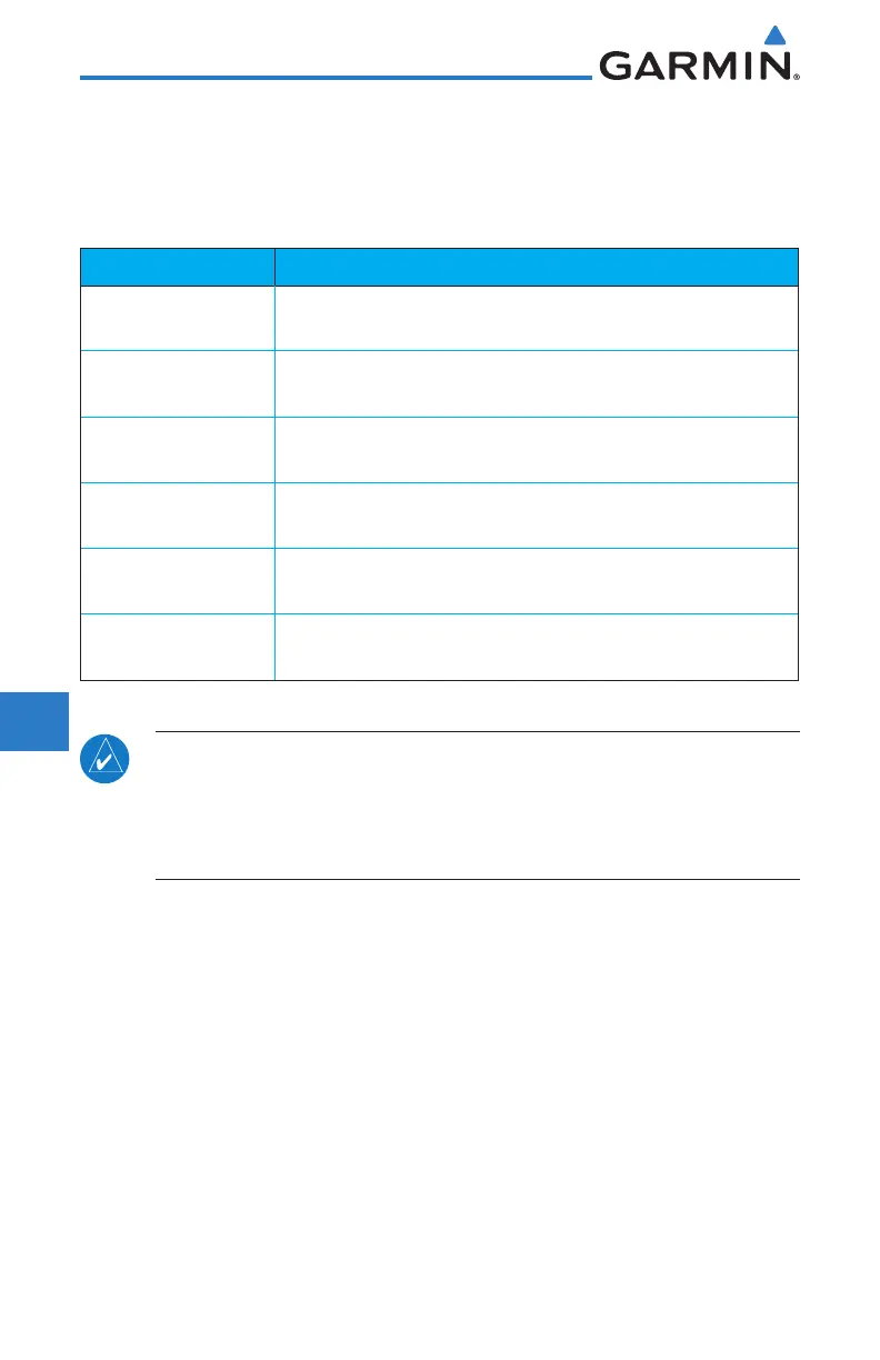
10.3.4 Terrain Database Areas of Coverage
The fixed-wing terrain database provides worldwide coverage. The following
describes the area of coverage available in each helicopter terrain database.
Regional definitions may change without notice.
Database Coverage Area
Americas - North
Latitudes: 0° to N90°
Longitudes: W180° to W30°
Americas - South
Latitudes: N30° to S90°
Longitudes: W180° to W30°
Atlantic - North
Latitudes: 0° to N90°
Longitudes: W30° to E90°
Atlantic - South
Latitudes: N30° to S90°
Longitudes: W30° to E90°
Pacific - North
Latitudes: 0° to N90°
Longitudes: E60° to E180°
Pacific - South
Latitudes: N30° to S90°
Longitudes: E60° to E180°
Table 10-3 Terrain Database Coverage
NOTE: Because of higher resolution helicopter terrain data, the world-wide
data won't fit on the terrain database card. Therefore, data is regionalized.
If you have the wrong region database for your present position, then you
get the message that terrain is unavailable for the current location and a
crosshatched pattern on the terrain display.

 Loading...


