10-42
GTN 625/635/650 Pilot’s Guide
190-01004-03 Rev. P
Foreword
Getting
Started
Audio &
Xpdr Ctrl
Com/Nav
FPL
Direct-To
Proc
Wpt Info
Map
Traffic
Terrain
Weather
Nearest
Services/
Music
Utilities
System
Messages
Symbols
Appendix
Index
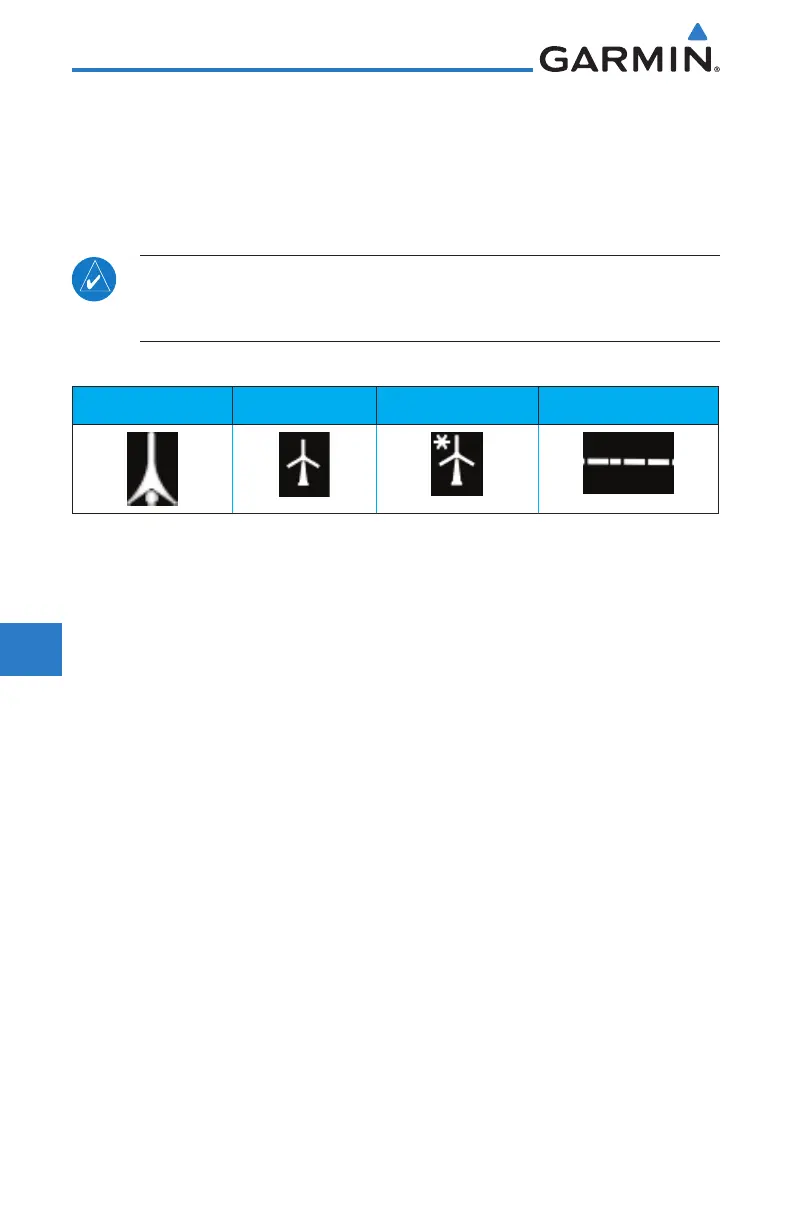
10.7.5 HTAWS Symbols
The symbols and colors in the following figures and table are used to represent
obstacles and the location of terrain threats on the HTAWS page. Each color is
associated with a height above terrain.
Obstacles are ALWAYS shown on the HTAWS page at 10 NM and below.
NOTE: If an obstacle or terrain cell and the projected flight path of the
aircraft intersect, the display automatically zooms in to the closest threat
location on the HTAWS Page.
Tower Windmill Windmill in Group Power Line
Table 10-18 Obstacle Icon Types
Grouped obstacles are shown with an asterisk (as shown in the Windmill in
Group example above). The color of the asterisks is tied to the relative altitude
of the highest obstacle in the group, not other obstacles within that group.
Obstacles are grouped when they would otherwise overlap.

 Loading...


