10-43190-01004-03 Rev. P
GTN 625/635/650 Pilot’s Guide
Foreword
Getting
Started
Audio &
Xpdr Ctrl
Com/Nav
FPL
Direct-To
Proc
Wpt Info
Map
Traffic
Terrain
Weather
Nearest
Services/
Music
Utilities
System
Messages
Symbols
Appendix
Index
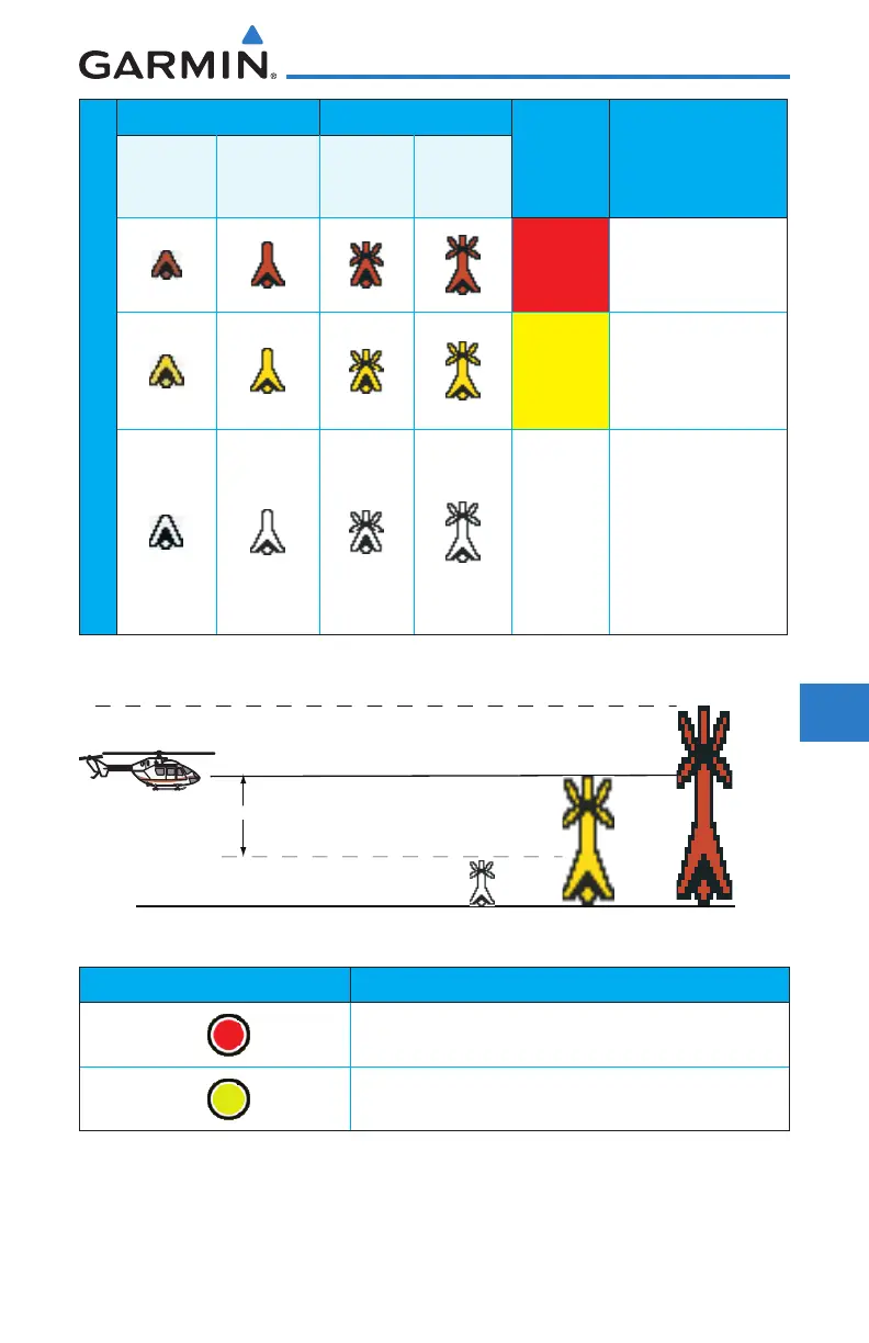
Unlighted Obstacle Lighted Obstacle
Obstacle
Color
Obstacle Location
< 1,000 ft
AGL
> 1,000 ft
AGL
< 1000 ft
AGL
> 1000 ft
AGL
Obstacle Symbol
Red
Obstacle is at or
above current
aircraft altitude.
Yellow
Obstacle is between
250 ft and 0 ft
below current
aircraft altitude.
White
Obstacle is 250 ft, or
more, below current
aircraft altitude.
Obstacles are
removed when more
than 500 ft below
the helicopter.
Table 10-19 HTAWS Obstacle Colors and Symbology
Obstacle is at or above the aircraft altitude (Red)
250 ft
Obstacle is between 250 ft and 0 ft
below the aircraft altitude (Yellow)
Obstacle is 250 ft, or more,
below the aircraft altitude (White)
Figure 10-30 HTAWS Obstacle Altitude Colors and Symbology
Threat Location Indicator Alert Level
WARNING (Red)
CAUTION (Yellow)
Table 10-20 HTAWS Alert Coloring and Symbology

 Loading...


