10-36
GTN 625/635/650 Pilot’s Guide
190-01004-03 Rev. P
Foreword
Getting
Started
Audio &
Xpdr Ctrl
Com/Nav
FPL
Direct-To
Proc
Wpt Info
Map
Traffic
Terrain
Weather
Nearest
Services/
Music
Utilities
System
Messages
Symbols
Appendix
Index
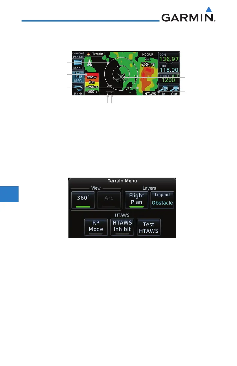
10.7.4 HTAWS Page
HTAWS is shown on the Terrain page when HTAWS is available.
HTAWS
Annunciation
HTAWS Terrain
Colorization Overlay
Rotorcraft
Ownship
Terrain Legend
360º View
Icon shows wire
obstacle overlay is active
(software v5.12, or later)
Icon shows point
obstacle overlay is active
(software v5.12, or later)
Figure 10-25 Terrain/HTAWS Page
Terrain information, aircraft ground track, and GPS-derived MSL altitude are
displayed on the page. The “GSL” above altitude display in the top right corner
of the display reminds the pilot that altitude is GPS-derived.
The HTAWS page menu provides options to acknowledge caution alerts,
reduce protection, or inhibit alerting.
Figure 10-26 HTAWS Terrain Menu

 Loading...


