13. Technical Data
353
Accuracy
Accuracy is dependent upon various factors including the number of satellites tracked, constellation geometry, observation
time, ephemeris accuracy, ionospheric
disturbance, multipath and resolved ambiguities.
The following accuracies, given as root mean square, are based on measurements processed using Leica Geomatic Office
(LGO) and on real time measurements. Higher accuracies can be achieved using specialist port processing software.
The use of multiple GNSS systems can increase accuracy by up to 30% relative to GPS only.
Differential code
The baseline precision of a differential code solution for static and kinematic surveys is 25 cm.
Differential phase in post-processing
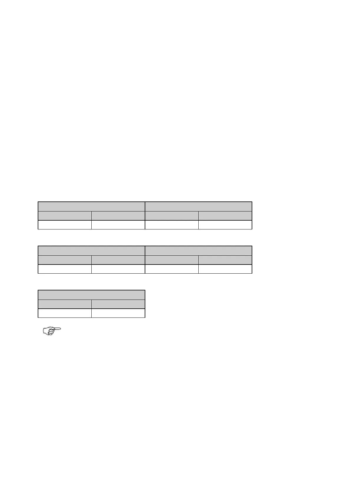
Accuracy (rms) with Real Time (RTK) with GR10/GR25/GM10 plus AS10
Accuracy (rms) with post processing with GR10/GR25/GM10 plus AS10
Accuracy (rms) with post processing with GR10/GR25/GM10 plus AR10/AR20/AR25
Measurement precision, accuracy and reliability are dependent upon various factors including number of
satellites, geometry, obstructions, observation time, ephemeris accuracy, ionospheric conditions, multipath
etc. Figures quoted assume normal to favourable conditions. Times required are dependent upon various
factors including number of satellites, geometry, ionospheric conditions, multipath etc. GPS and GLONASS
can increase performance and accuracy by up to 30% relative to GPS only. A full Galileo and GPS L5
constellation will further increase measurement performance and accuracy
 Loading...