190-02246-10 GI 275 Part 23 AML STC Installation Manual
Rev. 11 Page 3-20
3.3 Interfaces to Other Equipment
Information in this section provides details for interfacing to equipment not installed by the GI 275 STC.
The information provided must be reviewed when these interfaces are considered.
3.3.1 GPS Source
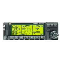
The GI 275 has a built-in VFR GPS source that can be used with the backup GPS antenna installed. Up to
two additional external GPS sources can be interfaced to the GI 275.
3.3.2 Navigation Receiver
The GI 275 attitude display uses data from a navigation receiver to display VOR and ILS information on
the HSI. Up to two independent navigation receivers can be interfaced to a display. The third-party
composite NAV connection must be directly connected to a GI 275 display when present.
3.3.3 Radar Altimeter
The GI 275 can receive data from a digital radar altimeter system to provide the display of radar altitude.
The display can also be configured to allow for the initiation of the radar altimeter self-test for certain radar
altimeter models. Radar altimeters must be wired to a discrete output from the GI 275 to enable self-test.
3.3.4 Traffic
The GI 275 can receive data from an ADS-B/TIS/TAS/TCAS I traffic system to display traffic.
Table 3-18 Traffic Interface
3.3.4.1 TIS-A
Traffic Information Service-equipped aircraft receive limited traffic information from nearby ground radar
uplinks. The GI 275 can interface with a GTX 33X to provide TIS-A. The traffic data can be crossfilled to
display on other GI 275 units.
3.3.4.2 TAS / TCAS
The GI 275 can interface with a number of traffic sources that function as Traffic Advisory Systems (TAS)
or Traffic Alert and Collision Avoidance Systems (TCAS). The traffic data can be crossfilled to display on
other GI 275 units.
3.3.4.3 TIS-B / FIS-B / ADS-B
TIS-B/FIS-B/ADS-B In-equipped aircraft receive traffic information from nearby ADS-B ground stations
and ADS-B Out-equipped aircraft. The GI 275 can receive and display weather and traffic services with
compatible equipment installed. The traffic data can be displayed on all GI 275 units capable of displaying
traffic data. Refer to Appendix Section C.13 for compatible equipment.
Source Interface Details
Heading
The heading source for existing traffic systems can be the GI 275 (via ARINC 429) or from
another approved heading source in accordance with the traffic system installation guidance.
Altitude
The altitude source for existing traffic systems can be the GI 275 (via ARINC 429) or from another
approved altitude source in accordance with the traffic system installation guidance.
