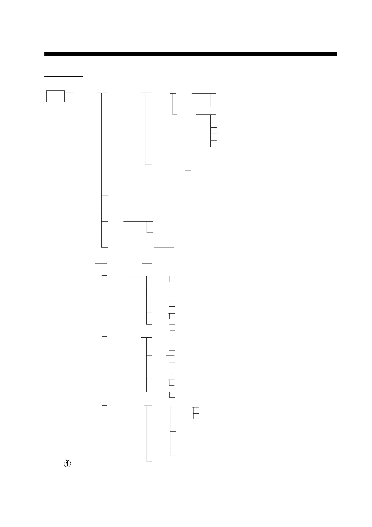
MENU
bar
(click)
General
Ship & Route
Parameters
Sensor
(Con’t on next page)
Ship &
Route
Instant
Track
MAX Speed (0.1 to 80 kn, 22.1)
MAX Height (0.0 to 100 m, 16.1)
MAX Draught (0.0 to 50 m, 20.0)
MAX R.O.T*
WPT Approach*
WPT Prewarning*
Default Line Radius (0.01 to 3.0 NM, 0.80)
Default XTD Limit (10 to 3704 m, 185)
Default Safety Margin (0 to 1000 m, 40)
Cost (Input values for Hour, Heavy Fuel Oil,
Diesel Oil)
Fuel Consumption (Input values for Speed,
Heavy Fuel Oil, Diesel Oil)
Navigation Parameter (Show forwarding distances, set at installation.)
TCS (Select the ECDIS unit to control Autopilot.)
Cost
Parameters
Route Information Unit of “XTD” (m, NM)
* Set at installation
Delay before Initiating First Turn (30 to 600 sec, 60)
Turn Radius (0.02 to 3.00 NM, 1)
XTD Limit (Auto, Manual (10 to 3704m))
Route Check Strictly (On, Off)
Ship
Route
System/Local
Select
System
Sensor
Settings
Sensor Type (System Sensor, Local Sensor)
HDG Data Source (
Sensors
, Manual*
2
)
Stabilization Mode (Bottom, Water)
Sensor Type (GPS, LOG)
Data Source (Sensors, Manual)
SPD
COG/ Data Source (Sensors)
SOG
POSN Data Source (Sensors, Manual)
Local Sensor
Settings
HDG
SPD
COG/
SOG
POSN
Data Source (Sensors, Analog Gyro (No use), Manual*
2
Gyro Correction)
PRIM*
1
, Second*
1
Stabilization Mode ( Bottom, Water)
Sensor Type (GPS, LOG)
Data Source (Sensors, Manual, Reference SPD, Drift)
PRIM*
1
Other Sensor
Settings
Other
Sensor
Filter Status (Monitor status and integrity of sensors.)
PRIM*
1
, Second*
1
*
1
: Display only
*
2
: Not available
with IMO type.
PRIM*
1
PRIM*
1
PRIM*
1
, Second*
1
Wind
Depth
(Values for Bow, Mid and Aft)
Below
Trans.
Temperature (Temperature of water surface)
Water Current (Course and speed of water current)
Speed (kn, m/s)
Reference (APPARENT, NORTH, THEORETICAL)
Source of Wind ((T)HEORETICAL and (R)EL,
(T)HEORETICAL, (T)RUE, (R)EL)
Data Source (Sensors)
PRIM*
1
Data Source (Sensors, Manual)
PRIM*
1
, Second*
1

 Loading...