11. HOW TO MONITOR ROUTES
11-9
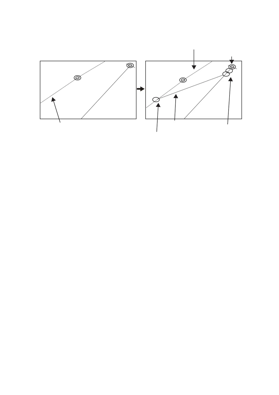
2. Click a leg or a waypoint on the monitored route. The location must be within
50 NM of current position.
The system uses ship position, speed and final waypoint to create a track. The track
is also checked for hazardous objects and the like against the chart alerts.
During the calculation, the [Instant Track] dialog box shows "Checking" in the [Status]
field. If, after completion of the calculation, the track is suitable, the message "OK" re-
places "Checking". The track and its waypoints, labeled [T1] - [T3], are colored or-
ange. The track is saved to the database as "Instant Track_XXX" (XXX=001 - 400).
If there is a problem with the track, an error message appears and the track is erased
from the screen. See section 11.8.3 for all the instant track messages and their mean-
ings.
Current position
Monitored route
Click a leg on monitored route.
Instant track
(orange)
Instant track
waypoints
(orange)
Point of return to route
WPT2
WPT2
T1
T2
T3