2. OPERATIONAL OVERVIEW
2-26
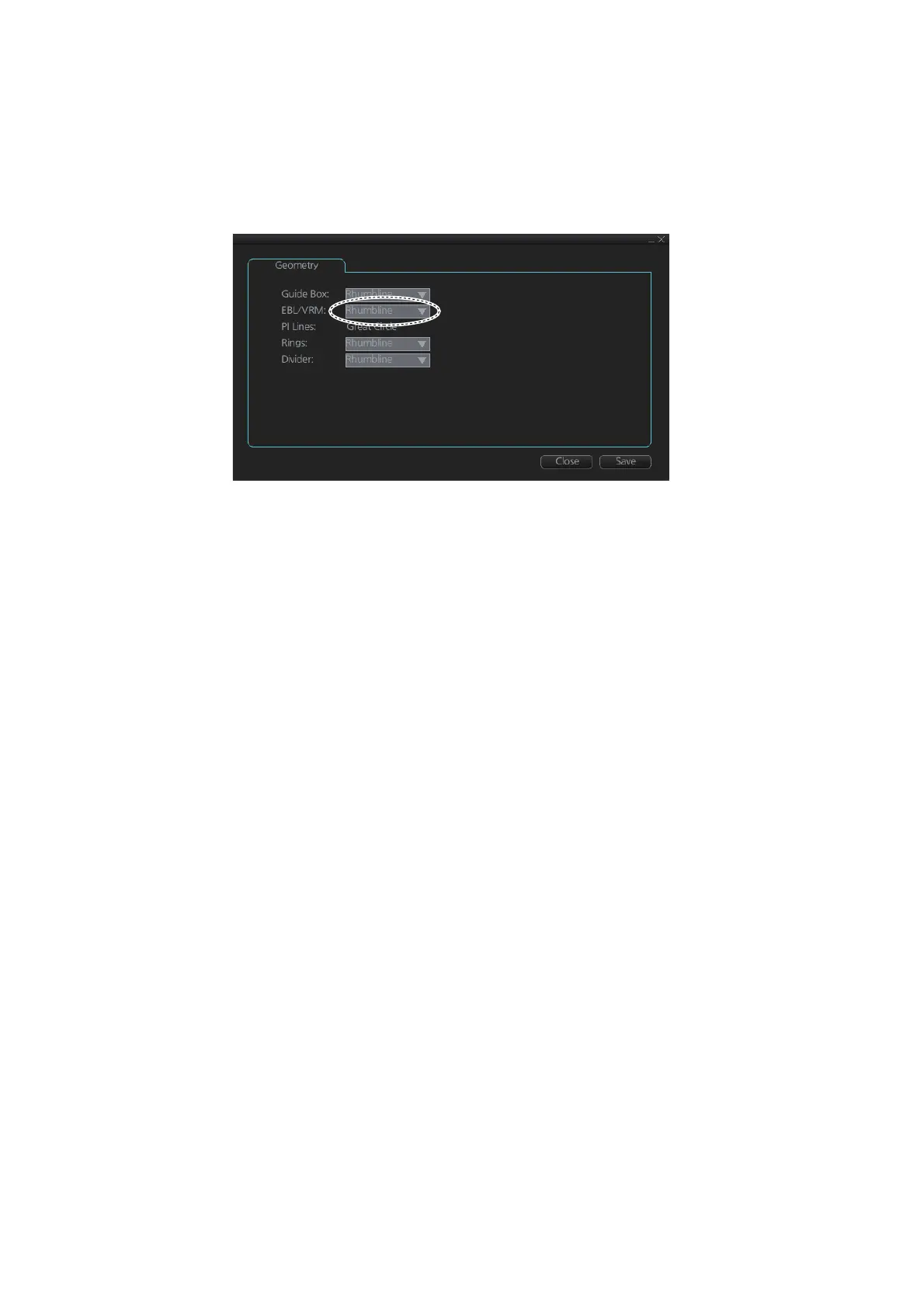
2.9.5 How to select range calculation method
The range calculation method for the EBL and VRM can be selected to Rhumbline or
Great Circle. Do as follows to select a calculation method.
1. Open the menu, then select [NAV Tools] and [Geometry] to show the [Geometry]
page.
2. Select [Rhumbline] or [Great Circle] with the drop down list box for [EBL/VRM].
3. Click the [Save] button to save the setting, then click the close button to finish.
2.10 Datum
2.10.1 General
Datum is a mathematical model of the earth based on which a sea chart is produced.
If the datum of a position sensor and that of a sea chart are different, a transformation
has to be made somewhere in the system. Not doing so can result in errors of several
sea miles. The difference between two datum is never constant, but depends on po-
sition. This means that the difference between WGS-84 and local datum, generally
used in paper charts, is not generally valid with electronic sea charts.
2.10.2 Paper charts
Datum used in paper charts have been traditionally national datum for historical rea-
sons. Many paper charts do not have a marked datum, therefore compatibility with
electronic charts may be complicated. In some paper charts, the correction terms are
printed in lieu of datum, for correction of the WGS-84 system satellite locations. The
correction terms are usable but only with the paper chart in question.
2.10.3 Electronic sea charts
• The ENC vector material has to be produced by a National Hydrographic Office in
the WGS-84 datum.
• The ARCS (raster) material includes polynomials for each chart, making it possible
for the ECS system to solve the difference between the WGS-84 datum and the lo-
cal datum with an accuracy sufficient for authority responsibility. In some charts, the
mentioned difference is not known with sufficient accuracy, resulting in displaying a
message in the Cursor position box when displayed in ARCS compatible systems.
 Loading...