18. NAVIGATION SENSORS
18-7
18.5 Source of Navigation Data
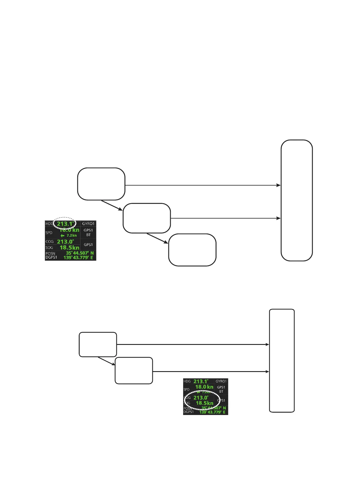
The figure below shows how various sources of navigation data are chosen. "SOG,
COG" is speed over the ground and course over the ground, respectively. "SPD" is
speed through the water. “Drift” is the difference between speed through the water and
speed over ground.
Heading used by the system is shown at the top-right position on the chart display. In
the example shown below, heading is received from a gyrocompass and it is shown
without additional text, meaning the value is referenced to true North. Additional gyro-
related text that may appear is "(GYRO-A)" if the value is referenced to magnetic
North.
SOG/COG used by the system is shown at the top-right position on the chart display.
In the example below, COG and SOG are from chosen position sensors and this is
indicated with the text "GPS*" or "LOG*" (* is the number of sensors).
Heading sensor
selected as high
priority
Alert 30801
“Heading
Sensor Not
Available”
Heading
used by
this system
Valid data exists
Valid data exists
No valid
data exists
GPS1
No valid
data exists
Heading sensor
selected as low
priority
SOG/COG
used by
this system
Valid data exists
Valid data exists
No valid
data exists
COG/SOG
calculated from
speed log
COG/SOG from
position sensor
 Loading...