Garmin aera 660 Pilot’s Guide
190-02017-20 Rev. E
86
Flight Planning
OverviewNavigationFlight PlanningHazard AvoidanceAdditional FeaturesAppendicesIndex
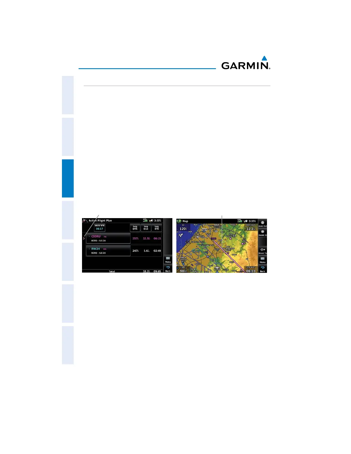
ACTIVATING VECTORS-TO-FINAL
After an approach has been activated, the 'Activate Vectors-to-Final' menu option
is used when being vectored to the final approach course by Air Traffic Control (ATC).
When Vectors-to-Final are activated, the aera 660 creates an extension of the final
course, beyond the final approach waypoint in the database (final approach fix [FAF]).
A Vector to Final symbol appears beside the first approach waypoint in the Active Flight
Plan.
Activating/Cancelling Vectors-to-Final:
1)
From the Main Menu, touch Active Flight Plan.
2)
While navigating an Active Flight Plan (with an approach activated), touch
the Menu Icon.
3)
Touch the active approach.
4)
Touch Activate Vectors-to-Final or Cancel Vectors-to-Final.
Vectors-to-Final (Active Flight Plan)
Final Course
Extension
Vectors-to-Final (Map)
Vectors-to-
Final Symbol
The aera 660 provides no guidance to the inbound course. The course deviation
needle on the graphic HSI remains off-center until established on the final approach
course. The map shows an extension of the final approach course using a bold
magenta line.
If Vectors-to-Final are not activated, the aera 660 creates a straight-line course
directly to the first waypoint in the approach.
Loading the approach cancels the Direct-to and initiates a route to the FAF.

 Loading...


