Garmin aera 660 Pilot’s Guide
190-02017-20 Rev. E
Appendix G
199
Overview Navigation Flight Planning Hazard Avoidance Additional Features Appendices Index
Changing the track vector settings on the Navigation Map:
1)
From the Main Menu, touch Map > Menu > Set Up.
2)
Touch the Dedicated Page Icon and touch the 'Line' Group.
3)
Touch the Track Vector button and touch Off, Distance, or Time.
4)
If Distance is selected, use the keypad to enter the desired distance and
touch Enter.
5)
If Time is selected, use the + / - buttons to select the desired time.
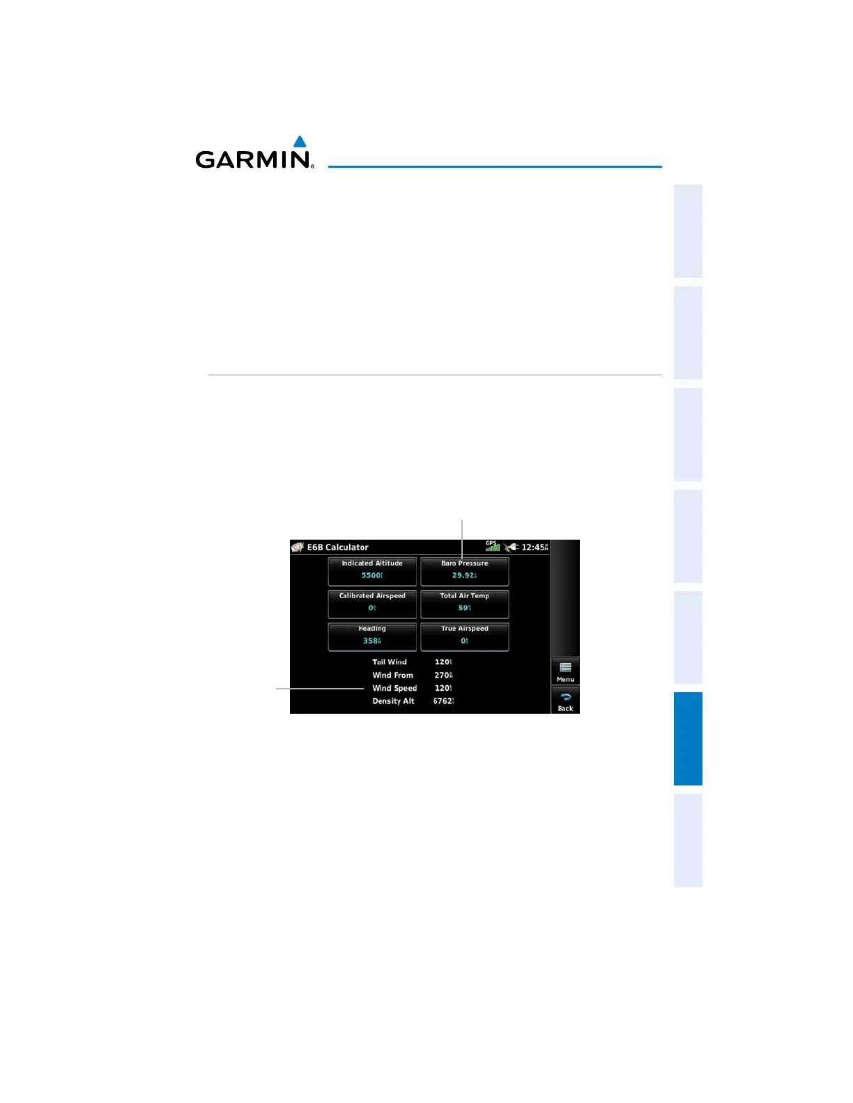
E6B CALCULATOR
The E6B Calculator calculates Density Altitude, True Airspeed, Tail Wind, Wind From,
and Wind Speed, based on information entered.
Accessing the E6B calculator:
Fr
om the Main Menu, touch Tools > E6B.
Calculated
Figures
E6B Calculator
Barometric Pressure
from the Nearest
METAR
UÊ
I
ndicated Altitude—
required entry for density altitude/true airspeed calculation.
Enter the aircraft’s altimeter reading.
s Baro Pressure—
enter the current barometric pressure.
s Calibrated Airspeed—
required entry for density altitude/true airspeed calculation.
Enter the aircraft’s airspeed indicator value.

 Loading...


