Garmin aera 660 Pilot’s Guide
190-02017-20 Rev. E
53
Navigation
Overview Navigation Flight Planning Hazard Avoidance Additional Features Appendices Index
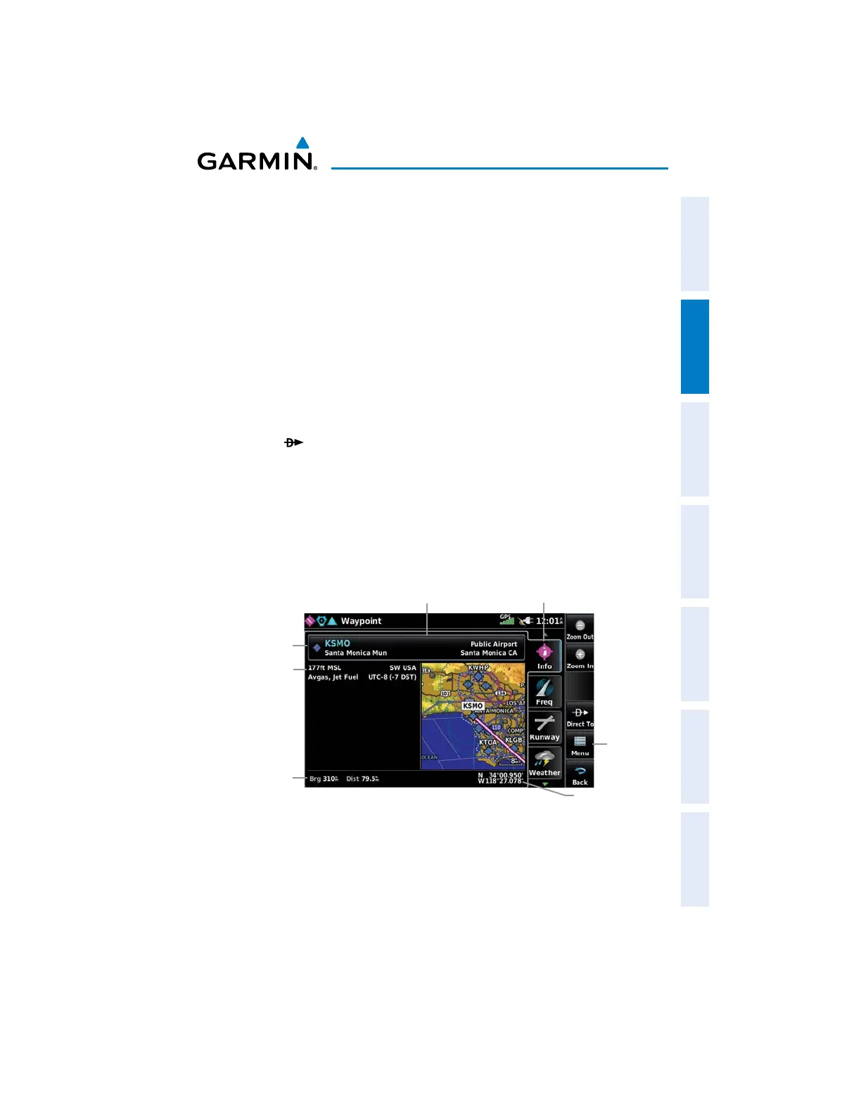
2.5 WAYPOINTS
The WPT INFO (Waypoint Information) function provides airport and waypoint
information.
Waypoints are predetermined geographical positions (internal database) or pilot-
entered positions, and are used for all phases of flight planning and navigation.
Waypoints can be selected by entering the ICAO identifier, entering the name of
the facility, or by entering the city name. As a waypoint identifier, facility name, or
location is entered, the aera 660’s Spell’N’Find™ feature scrolls through the data-
base, displaying those waypoints matching the characters which have been entered
up to that point. A direct-to navigation leg to the selected waypoint can be initiated
by pressing the Icon.
The waypoint function allows the pilot to review airport information, runway
information, frequencies, AOPA information (if available), and weather information (if
available) by touching the desired tab. The pilot can manually enter the identifier or
the aera 660 will choose the most appropriate identifier based on the current posi-
tion and phase of flight.
-Waypoint Identifier/Symbol/Type
-Facility Name
-City/State
Lat/Long
Info Tab
Option
Menu
Waypoint Information (Info Tab)
Bearing/
Distance
Waypoint
Identifier
Button
-Elevation
-Region
-Fuel Available
-Time Zone
(UTC Offset)
The following descriptions and abbreviations are used:
s5SAGETYPE0UBLIC-ILITARYOR0RIVATE
s2UNWAYSURFACETYPE(ARD4URF3EALED'RAVEL$IRT3OFT5NKNOWNOR7ATER

 Loading...


