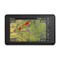
Garmin aera 660 Pilot’s Guide
190-02017-20 Rev. E
34
Overview
OverviewNavigationFlight PlanningHazard AvoidanceAdditional FeaturesAppendicesIndex
3D Vision
Bug Indicator, Ground Speed, Altitude, Heading, Lateral Deviation,
Vertical Deviation, Vertical Speed, Slip/Skid, Synthetic Vision, Panning
Timeout
Navigation
Waypoint Transition Mode settings (Auto or Distance)
Keyboard
Keyboard layout setup
1.7 NEAREST AIRPORT CRITERIA SETTINGS
The Nearest Airports Option Menu allows the pilot to filter out airports that do not
meet a defined criteria. Specific surface types and runway lengths can be defined, as
well as the option to include private airports and/or heliports.
Runway Surface—allows you to set criteria for the type of surface on the runway:
s
Hard Only—shows only runways with a concrete, asphalt, or similar sealed
surface.
s
Hard or Soft—shows all runways except water landing facilities.
s
Water Only—shows only water landing facilities.
s
Any—shows any runway, regardless of surface type, including water landing
facilities.
Minimum Runway Length—allows the pilot to enter a specific length for the shortest
runway allowed.
Entering airport criteria:
1)
From the Main Menu, touch Nearest.
2)
Touch the dedicated page icon and touch Airport.
3)
Touch Menu.
4)
Touch Surface, and touch the desired runway surface from the list.
5)
Touch Min Length, and enter the desired Minimum Runway Length using
the keypad.
6)
Touch Private Airports to include Private Airports in the search.
7)
Touch Heliports to include Heliports in the search.
8)
Touch City Names or Facility Names to display the airport's city or
facility name.

 Loading...