Garmin aera 660 Pilot’s Guide
190-02017-20 Rev. E
122
Hazard Avoidance
OverviewNavigationFlight PlanningHazard AvoidanceAdditional FeaturesAppendicesIndex
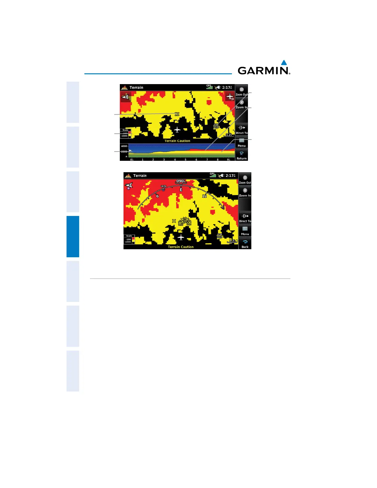
Terrain Profile
View
Terrain
Legend
Terrain 'Map with Profile' View
Obstacle
Red Terrain is
above or within
100 ft below the
aircraft.
Yellow Terrain is
Between the User-
defined Caution
Elevation and
100 ft Below the
Aircraft
Potential
Impact
Point
Terrain 'Map Only' View
TERRAIN ALERTS & SETUP
Enabling/Disabling terrain alerts:
1)
From the Main Menu, touch Terrain.
2)
Touch Menu.
3)
Touch Alerts to toggle between Enabled and Inhibited.
Use the Terrain Setup Menu to set levels for terrain alerts as well as obstacles in
or near the flight path.
sCaution Elevation—The aera 660 will provide an alert if the terrain or obstacle is
within the default Caution Elevation or user-defined Caution Elevation
sLook Ahead Time—Determines the maximum time when an alert annunciation
occurs. For example, if 120 seconds is selected, the aera 660 provides an alert up
to 120 seconds before reaching the terrain or obstacle

 Loading...


