Garmin aera 660 Pilot’s Guide
190-02017-20 Rev. E
70
Navigation
OverviewNavigationFlight PlanningHazard AvoidanceAdditional FeaturesAppendicesIndex
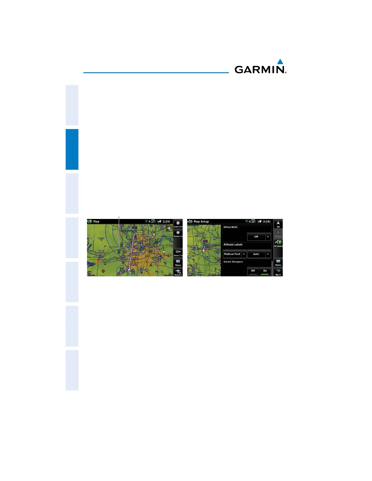
AIRSPACE ALT ITUDE LABELS
Airspace labels are displayed on any airspace visible on the Navigation Map,
worldwide. With Smart Airspace configured, the labels are deemphasized when
appropriate. Range visibility and label size are configured under the 'Airspace' Map
Setup Menu.
Airspace altitude label setup:
1)
From the Main Menu, touch Map > Menu > Set Up.
2)
Touch the Dedicated Page Icon, and touch Airspace.
3)
Touch the Down Button to view the Altitude Labels configuration
options.
4)
Select the desired range visibility and/or text size.
Airspace Altitude Labels (Map Page)
Airspace
Altitude
Label
Airspace Altitude Labels (Map Setup Page)
2.6 DIRECT-TO NAVIGATION
The Direct-to method of navigation, initiated by pressing the Direct To Icon is
quicker to use than a flight plan when the desire is to navigate to a single point such
as a nearby airport.
The Direct To Icon is available in the dedicated page icons on the right side of most
pages.
Once a direct-to is activated, the aera 660 establishes a point-to-point course line
from the present position to the selected direct-to destination. Course guidance is
provided until the direct-to is replaced with a new direct-to or flight plan, or cancelled.

 Loading...


