EasyManuals Logo

Garmin AERA 660 User Manual

Garmin AERA 660
244 pages
To Next Page IconTo Next Page
To Previous Page IconTo Previous Page
Page #40 background imageLoading...
Page #40 background image
Garmin aera 660 Pilot’s Guide
190-02017-20 Rev. E
24
Overview
OverviewNavigationFlight PlanningHazard AvoidanceAdditional FeaturesAppendicesIndex
MAP OVERLAYS
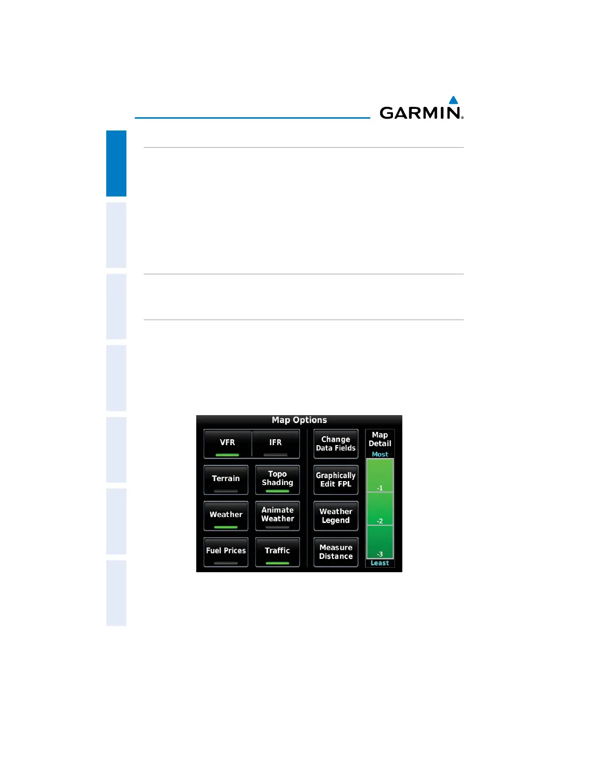
The VFR, IFR, Terrain, Topography, Weather, Fuel Prices, or Traffic map overlays can
be displayed or removed.
Displaying/removing map overlays:
1)
From the Main Menu, touch Map > Menu.
2)
Touch VFR, IFR, Terrain, Topo Shading, Weather/Animate Weather,
Fuel Prices, or Traffic to display or remove the map overlay.
MAP SYMBOLS
Refer to Appendix H for a list of map symbols.
MAP DETAIL
The map can be adjusted to declutter the map.
Adjusting the declutter level of the Navigation Map:
1)
From the Main Menu, touch Map > Menu.
2)
Touch the desired Map Detail level (-1, -2, -3) on the right side of the
screen. The currently selected level is highlighted green.
Map Detail

Table of Contents

Other manuals for Garmin AERA 660

Questions and Answers:

Question and Answer IconNeed help?

Do you have a question about the Garmin AERA 660 and is the answer not in the manual?

Garmin AERA 660 Specifications

General IconGeneral
Display Resolution480 x 800 pixels
TouchscreenYes
Battery LifeUp to 4 hours
Voltage Range10-35 V
Display TypeWVGA color TFT
ConnectivityBluetooth
Preloaded MapsYes
Weather UpdatesYes
Traffic UpdatesNo
Receiver TypeGPS/GLONASS
Operating Temperature-4°F to 131°F (-20°C to 55°C)
Weather SupportYes
Traffic SupportNo

Related product manuals