Garmin aera 660 Pilot’s Guide
190-02017-20 Rev. E
125
Hazard Avoidance
Overview Navigation Flight Planning Hazard Avoidance Additional Features Appendices Index
4.3 TRAFFIC
The following compatible devices are designed to receive, process, and forward
traffic (ADS-B air-to-air, and TIS-B traffic information), and weather (Flight Information
Service-Broadcast (FIS-B)) information to the aera through a power/data cable or
Bluetooth.
Compatible ADS-B Devices
GDL 39/39R
GDL 39-3D
GTX 345/345R/45R
GDL 50/50R
GDL 52/52R
GNX 375
TRAFFIC INFORMATION SERVICE (TIS-A)
NOTE:
Refer to Appendix F for general information regarding TIS-A. Refer to
Appendix D for configuration information.
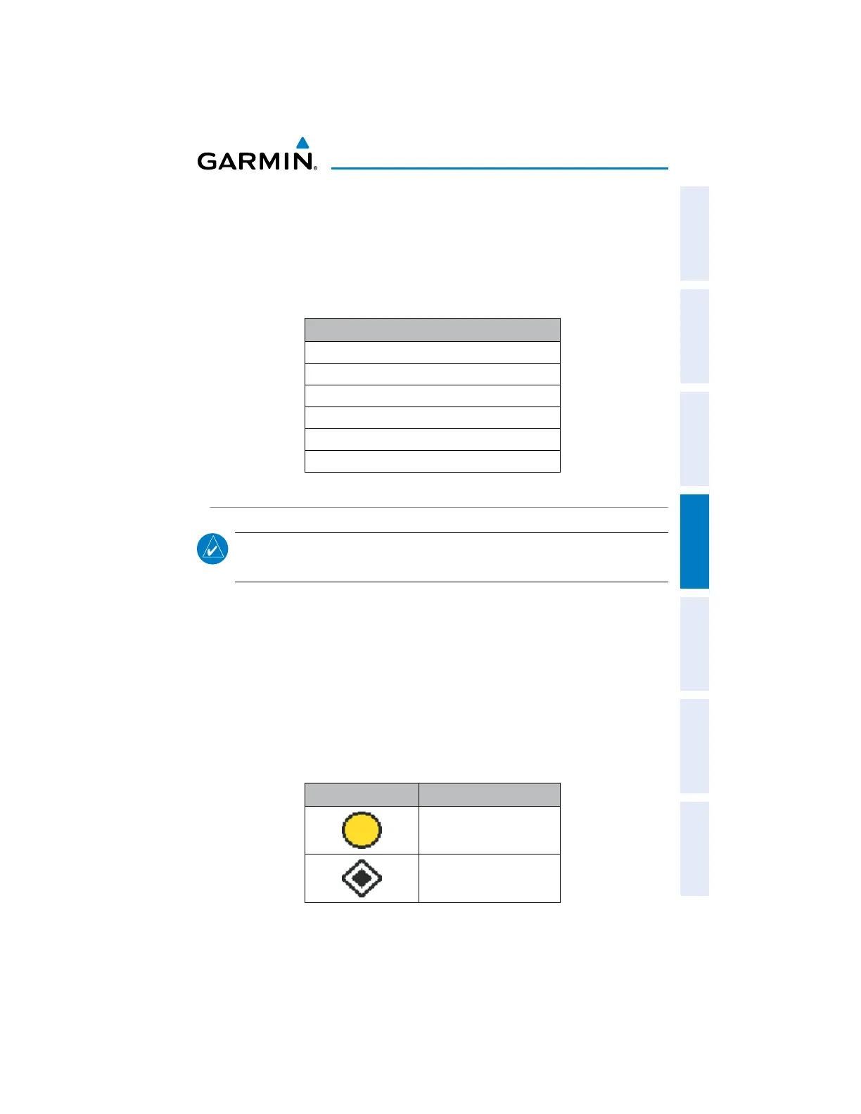
TIS-A SYMBOLOGY
TIS-A traffic is shown according to TCAS symbology, graphically shown on the
Navigation Map, and in the Traffic Warning Window. A Traffic Advisory (TA) symbol
appears as a solid yellow circle. All other traffic is shown as a hollow white diamond.
Altitude deviation from own aircraft altitude is shown above the target symbol if traffic
is above own aircraft altitude, and below the symbol if they are below own aircraft
altitude. Altitude trend is shown as an up arrow (>+500 ft/min), down arrow (<-500
ft/min), or no symbol if less than 500 ft/min rate in either direction.
TIS-A Symbol Description
Traffic Advisory (TA)
Other Traffic
TIS-A Traffic Symbols

 Loading...


