Garmin G1000 Pilot’s Guide for the Diamond DA42NG
190-00962-04 Rev. A160
FLIGHT MANAGEMENT
SYSTEM
OVERVIEW
FLIGHT
INSTRUMENTS
EIS
AUDIO PANEL
& CNS
FLIGHT
MANAGEMENT
HAZARD
AVOIDANCE
AFCS
ADDITIONAL
FEATURES
APPENDICESINDEX
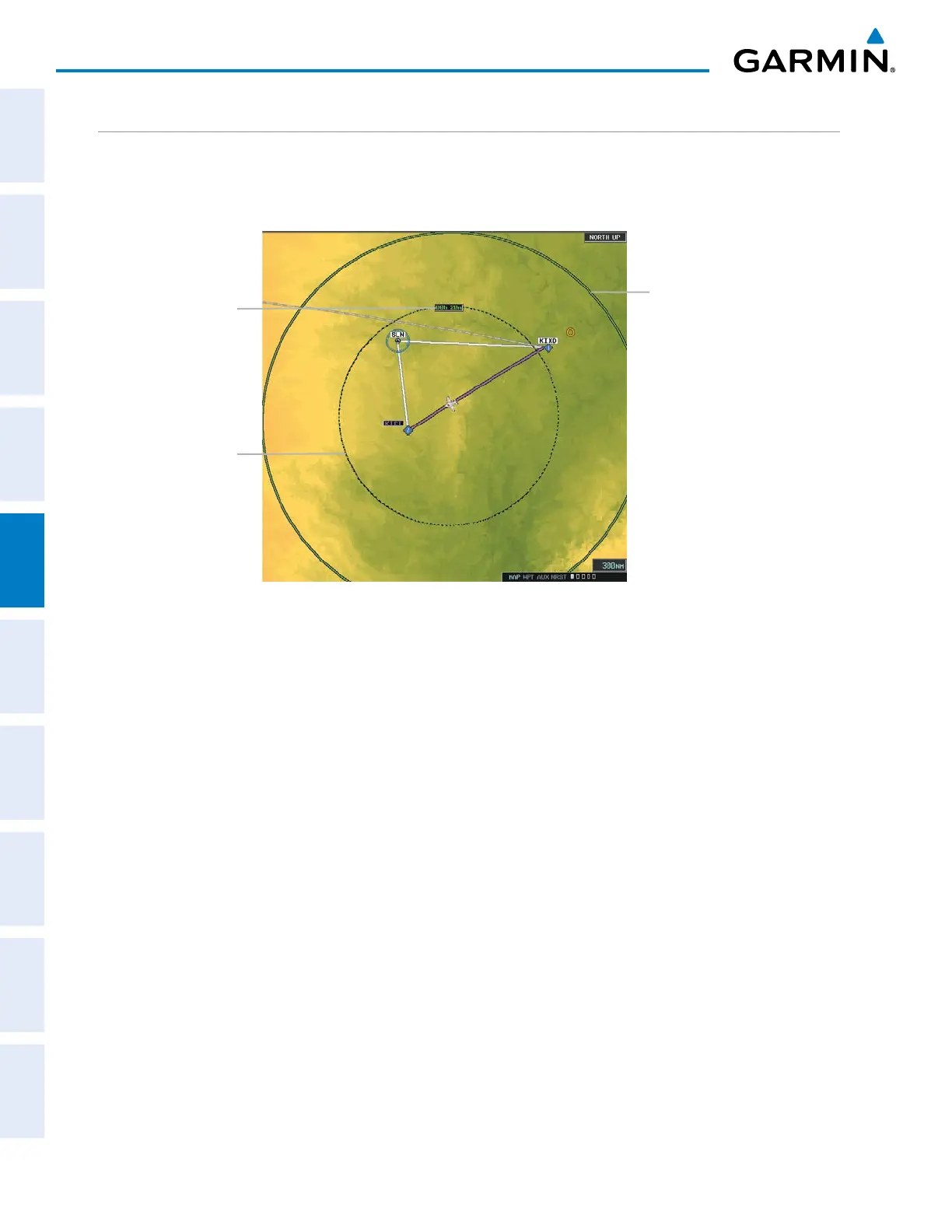
FUEL RANGE RING
The map can display a fuel range ring which shows the remaining flight distance. A dashed green circle
indicates the selected range to reserve fuel. A solid green circle indicates the total endurance range. If only
reserve fuel remains, the range is indicated by a solid amber circle.
Figure 5-28 Navigation Map - Fuel Range Ring
Range to Reserve Fuel
Time to Reserve Fuel
Total Endurance Range
Displaying/removing the fuel range ring and selecting a fuel range time:
1) Press the MENU Key with the Navigation Map Page displayed. The cursor flashes on the ‘Map Setup’ option.
2) Press the ENT Key. The Map Setup Menu is displayed.
3) Select the ‘Map’ group.
4) Press the ENT Key.
5) Highlight the ‘FUEL RNG (RSV)’ field.
6) Select ‘On’ or ‘Off’.
7) Highlight the fuel reserve time field. This time should be set to the amount of flight time equal to the amount
of fuel reserve desired.
8) To change the reserve fuel time, enter a time (00:00 to 23:59; hours:minutes). The default setting is 00:45
minutes.
9) Press the ENT Key.
10) Press the FMS Knob to return to the Navigation Map Page.

 Loading...


