Garmin G1000 Pilot’s Guide for the Diamond DA42NG
190-00-00962-04 Rev. A
380
HAZARD AVOIDANCE
SYSTEM
OVERVIEW
FLIGHT
INSTRUMENTS
EIS
AUDIO PANEL
& CNS
FLIGHT
MANAGEMENT
HAZARD
AVOIDANCE
AFCS
ADDITIONAL
FEATURES
APPENDICESINDEX
6.4 AIRBORNE COLOR WEATHER RADAR
SYSTEM DESCRIPTION
The optional Garmin GWX 68 Airborne Color Weather Radar is a four-color digital pulsed radar with 6.5
kilowatts of output power. The Garmin GWX 70 Airborne Color Weather Radar is a solid-state pulsed radar
with forty watts of output power. The radar combines excellent range and adjustable scanning profiles with a
high-definition target display. The pulse width for the GWX 68 is four microseconds (µs) on all ranges except
the 2.5 nm range. The GWX 68 uses a one µs pulse width at this range to reduce the targets smearing together
on the display for better target definition at close range. The GWX 70 has an effective pulse length of 27.31
microseconds (µs), and the system optimizes the pulse length to maximize resolution at each range setting.
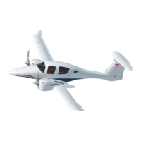
The Diamond DA42NG uses a 10-inch phased array antenna that is fully stabilized to accommodate 30º of
pitch and roll.
To focus radar scanning on specific areas, Sector Scanning offers pilot-adjustable horizontal scan angles of
20º, 40º, 60º, or 90º. A vertical scanning function helps to analyze storm tops, gradients, and cell buildup
activity at various altitudes.
Radar features include:
• Extended Sensitivity Time Constant (STC) logic that automatically correlates distance of the return echo with
intensity, so cells do not suddenly appear to get larger as they get closer.
• WATCH
®
(Weather ATtenuated Color Highlight) helps identify possible shadowing effects of short-range cell
activity, identifying areas where radar return signals are weakened or attenuated by intense precipitation (or
large areas of lesser precipitation) and may not fully reflect the weather behind a storm.
• Weather Alert that looks ahead for intense cell activity in the 80-320 nm range, even if these ranges are not
being monitored.
• For the GWX 70 only, Altitude-Compensated Tilt (ACT) management, which automatically adjusts the
antenna tilt angle as the aircraft altitude changes.
PRINCIPLES OF PULSED AIRBORNE WEATHER RADAR
The term RADAR is an acronym for RAdio Detecting And Ranging. Pulsed radar locates targets by transmitting
a microwave pulse beam that, upon encountering a target, is reflected back to the radar receiver as a return
echo. The microwave pulses are focused and radiated by the antenna, with the most intense energy in the
center of the beam and decreasing intensity near the edge. The same antenna is used for both transmitting and
receiving. The system processes the returned signal and displays it on the MFD.
Radar detection is a two-way process that requires 12.36 µs for the transmitted microwave pulses to travel out
and back for each nautical mile of target range. It takes 123.6 µs for a transmitted pulse to make the round trip
if a target is ten nautical miles away.
Airborne weather radar should be used to avoid severe weather, not for penetrating severe weather. The
decision to fly into an area of radar targets depends on target intensity, spacing between the targets, aircraft
capabilities, and pilot experience. Pulse type weather radar detects only precipitation, not clouds or turbulence.
The display may indicate clear areas between intense returns, but this does not necessarily mean it is safe to fly
between them. Only Doppler radar can detect turbulence.
 Loading...


