190-00962-04 Rev. A
Garmin G1000 Pilot’s Guide for the Diamond DA42NG
425
HAZARD AVOIDANCE
SYSTEM
OVERVIEW
FLIGHT
INSTRUMENTS
EIS
AUDIO PANEL
& CNS
FLIGHT
MANAGEMENT
HAZARD
AVOIDANCE
AFCS
ADDITIONAL
FEATURES
APPENDICES INDEX
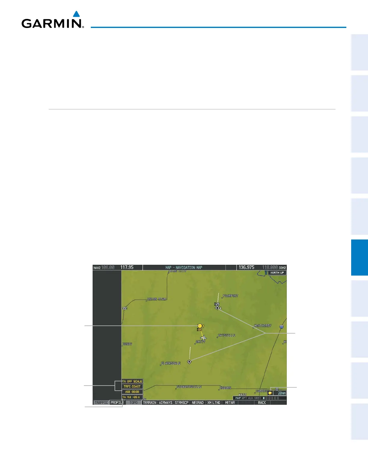
The altitude difference between the requesting aircraft and other intruder aircraft is displayed above/below the
traffic symbol in hundreds of feet. If the other aircraft is above the requesting aircraft, the altitude separation
appears above the traffic symbol; if below, the altitude separation appears below. Altitude trend is displayed as
an up/down arrow (for speeds greater than 500 fpm in either direction) to the right of the target symbol. Traffic
symbols for aircraft without altitude reporting capability appear without altitude separation or climb/descent
information.
DISPLAYING TRAFFIC DATA
The Map - Traffic Map Page is the principal page for viewing traffic information. Additional displays of traffic
information are available as map overlays while TIS is operating, and serve as additional reference to the Traffic
Map Page. Traffic information can be displayed on the following maps and pages:
• PFD Inset Map
• Navigation Map Page
• Traffic Map Page
• Trip Planning Page
• Nearest Pages
• Active Flight Plan Page
• AUX - Video Page
Displaying traffic information (maps other than the Traffic Map Page):
1) Press the MAP Softkey.
2) Press the TRAFFIC Softkey.
When traffic is selected on maps other than the Traffic Map Page, an icon is shown to indicate the feature is
enabled for display.
Figure 6-179 TIS Traffic on the Navigation Map Page
Traffic Advisory
Traffic Status
Banners
Traffic Display
Enabled
Non-Threat
Traffic
Non-Bearing
Traffic
Advisory

 Loading...


