Garmin G1000 Pilot’s Guide for the Diamond DA42NG
190-00-00962-04 Rev. A
384
HAZARD AVOIDANCE
SYSTEM
OVERVIEW
FLIGHT
INSTRUMENTS
EIS
AUDIO PANEL
& CNS
FLIGHT
MANAGEMENT
HAZARD
AVOIDANCE
AFCS
ADDITIONAL
FEATURES
APPENDICESINDEX
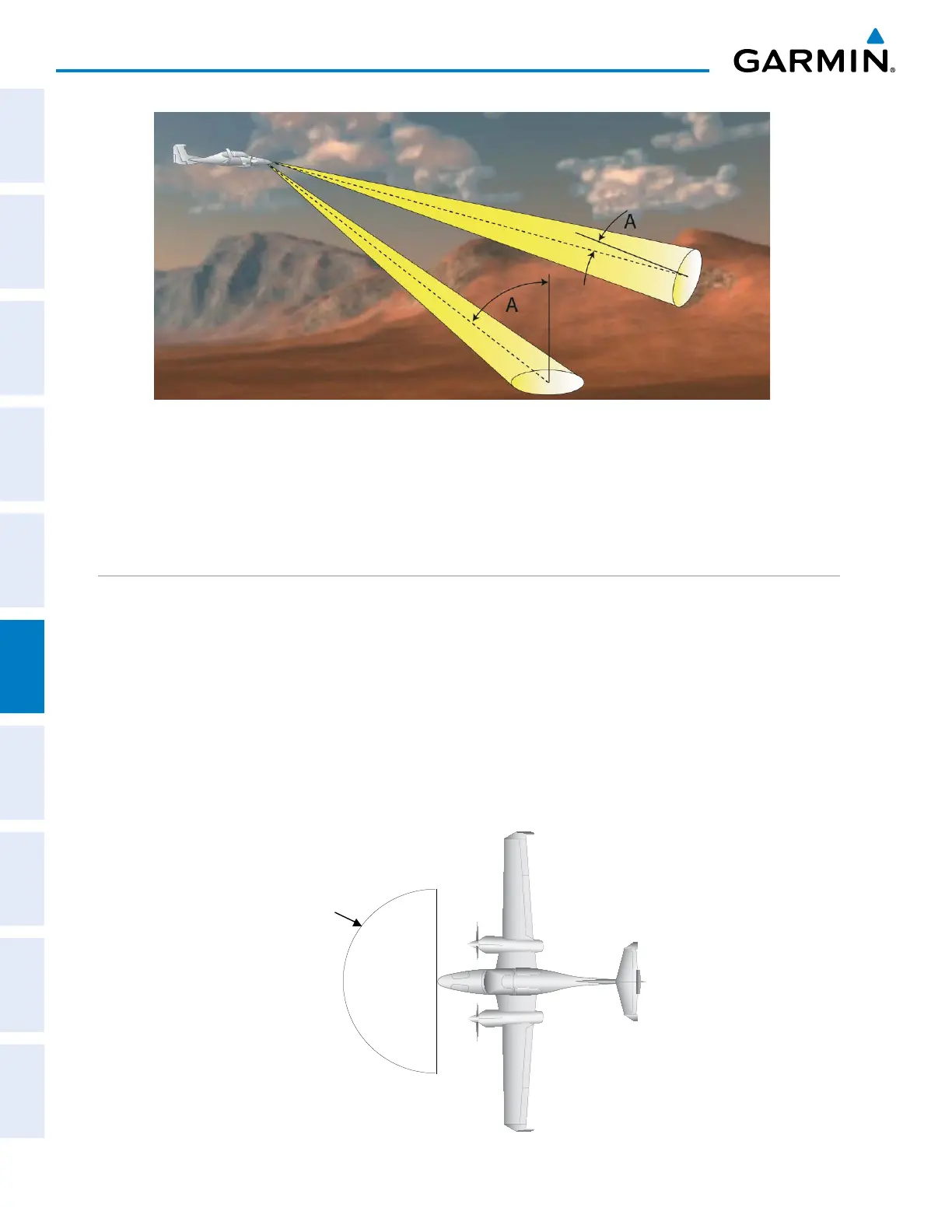
Figure 6-130 Angle of Incidence
A smaller incident angle gives the radar a larger detectable range of operation and the target display shows
a higher intensity. Since more radar energy is reflected back to the antenna with a low incident angle, the
resulting detectable range is increased for mountainous terrain.
SAFE OPERATING DISTANCE
The following information establishes a minimum safe distance from the antenna for personnel near
operating weather radar. The minimum safe distance is based on the FCC’s exposure limit at 9.3 to 9.5 GHz for
general population/uncontrolled environments, which is 1 mW/cm2. See Advisory Circular 20-68B for more
information on safe distance determination.
MAXIMUM PERMISSIBLE EXPOSURE LEVEL (MPEL)
The zone in which the radiation level exceeds the US Government standard of 1 mW/cm2 is the semicircular
area of at least 9.16 feet from the 10-inch antenna. All personnel must remain outside of this zone. With a
scanning or rotating beam, the averaged power density at the MPEL boundary is significantly reduced.
MPEL
Boundary
antenna
Figure 6-131 MPEL Boundary

 Loading...


