190-00962-04 Rev. A
Garmin G1000 Pilot’s Guide for the Diamond DA42NG
189
FLIGHT MANAGEMENT
SYSTEM
OVERVIEW
FLIGHT
INSTRUMENTS
EIS
AUDIO PANEL
& CNS
FLIGHT
MANAGEMENT
HAZARD
AVOIDANCE
AFCS
ADDITIONAL
FEATURES
APPENDICES INDEX
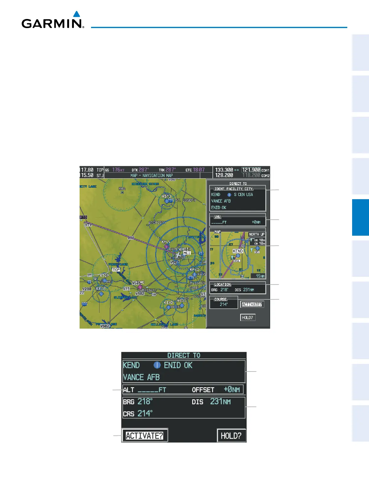
5.5 DIRECT-TO-NAVIGATION
The Direct-to method of navigation, initiated by pressing the Direct-to Key on either the MFD or PFD, is
quicker to use than a flight plan when the desire is to navigate to a single point such as a nearby airport.
Once a direct-to is activated, the G1000 establishes a point-to-point course line from the present position to the
selected direct-to destination. Course guidance is provided until the direct-to is replaced with a new direct-to or
flight plan, or cancelled.
A vertical navigation (VNV) direct-to creates a descent path (and provides guidance to stay on the path) from
the current altitude to a selected altitude at the direct-to waypoint. Vertical navigation is based on barometric
altitudes, not on GPS altitude, and is used for cruise and descent phases of flight.
The Direct-to Window allows selection and activation of direct-to navigation. The Direct-to Window displays
selected direct-to waypoint data on the PFD and the MFD.
Figure 5-54 Direct-to Window - MFD
Direct-to Point Info
- Identifier/Symbol/Region
- Facility Name
- City
Location of Destination
- Bearing/Distance
Map of Selected Point
Desired Course
VNV Constraints
- Altitude at Arrival
- Along Track Offset
Figure 5-55 Direct-to Window - PFD
Direct-to Point Info
- Identifier/Symbol/City
- Facility Name
Activation Command
Direct-to Point Info
- Bearing/Distance
- Desired Course
VNV Constraints
- Altitude at Arrival
- Along Track Offset

 Loading...


