Garmin G1000 Pilot’s Guide for the Diamond DA42NG
190-00-00962-04 Rev. A
336
HAZARD AVOIDANCE
SYSTEM
OVERVIEW
FLIGHT
INSTRUMENTS
EIS
AUDIO PANEL
& CNS
FLIGHT
MANAGEMENT
HAZARD
AVOIDANCE
AFCS
ADDITIONAL
FEATURES
APPENDICESINDEX
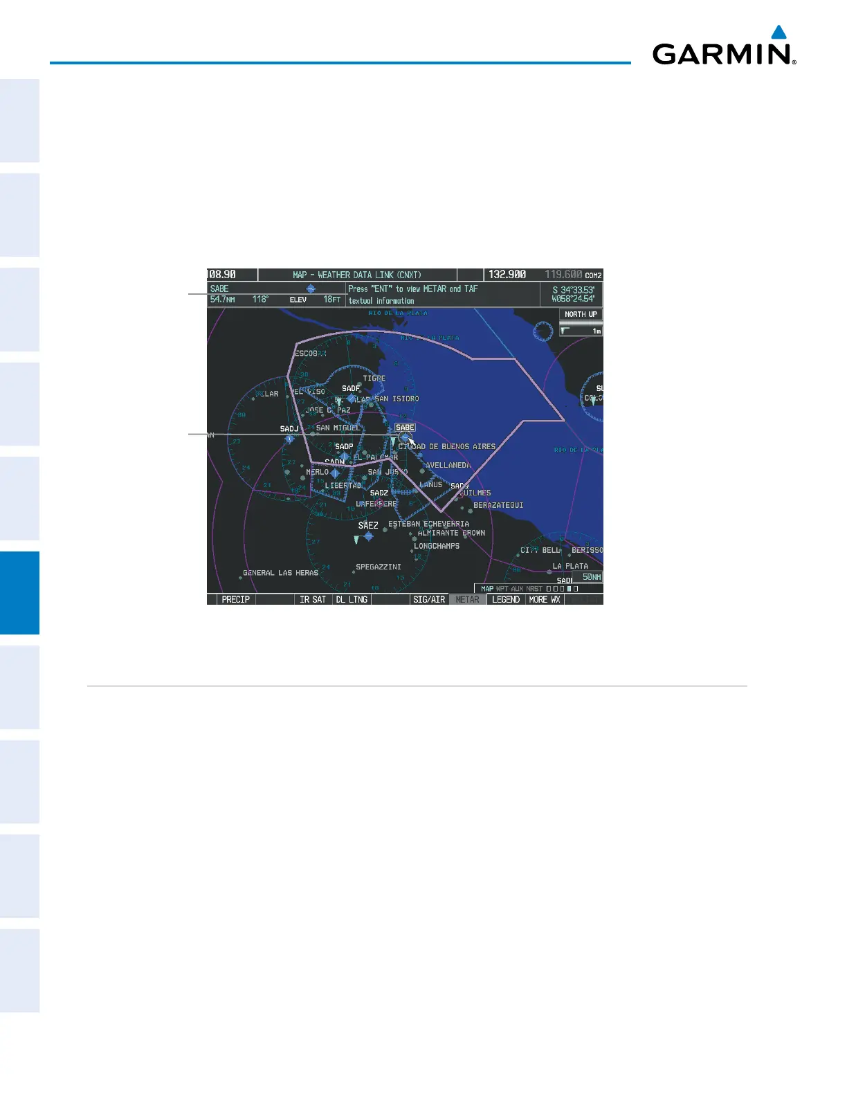
Additional information about the following can be displayed by panning over the display on the map:
• Infrared Satellite (IR SAT)
• SIGMETs
• AIRMETs
• METARs
• TFRs
• PIREPs
The map panning feature is enabled by pressing the Joystick. The map range is adjusted by turning the
Joystick. If the map range is adjusted while panning is enabled, the map is re-centered on the Map Pointer.
Figure 6-64 Map Panning on the Weather Data Link (CNXT) Page
Instructions
for Viewing
METAR and
TAF Text
METAR
Selected
with Map
Pointer
CONNEXT DATA REQUESTS
The Connext Data Request Menu provides the flight crew with the options to enable or disable the requested
weather coverage area(s), choose automatic weather update intervals (if desired), and the ability to send or
cancel weather data requests. The status of the Garmin Connext data request process is also displayed.
Before a Garmin Connext data request can occur, a valid request coverage area must be defined from which
all currently available Garmin Connext weather products will be retrieved. At a minimum, either the aircraft’s
present position or a waypoint (as part of a flight plan or entered directly in the ‘WAYPOINT’ coverage field)
must be part of the request coverage area, otherwise the request status window indicates ‘Invalid Coverage Area’
and the system will not allow a request to occur.
It is not necessary for a destination (based on an active flight plan), a flight plan, or waypoint to be specified
prior to enabling these coverage areas; however no weather data will be retrieved for these option(s) until a
flight plan or waypoint is provided, respectively.
Requesting Garmin Connext weather manually:
1) Select the Weather Data Link (CNXT) Page.
2) Press the MENU Key.

 Loading...


