190-00962-04 Rev. A
Garmin G1000 Pilot’s Guide for the Diamond DA42NG
359
HAZARD AVOIDANCE
SYSTEM
OVERVIEW
FLIGHT
INSTRUMENTS
EIS
AUDIO PANEL
& CNS
FLIGHT
MANAGEMENT
HAZARD
AVOIDANCE
AFCS
ADDITIONAL
FEATURES
APPENDICES INDEX
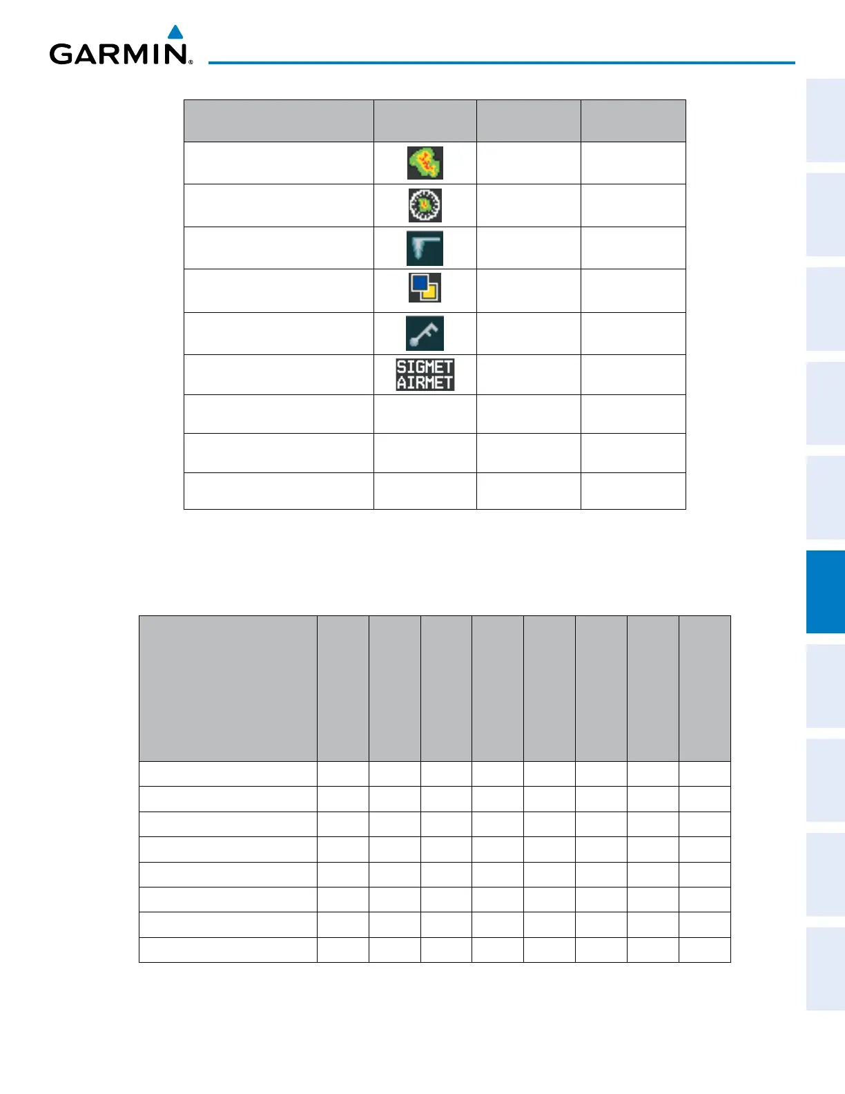
FIS-B Weather Product Symbol
Expiration Time
(Minutes)
Broadcast Rate
(Minutes)
NEXRAD Composite (US) 30 15
NEXRAD Composite (Regional) 30 2.5
Meteorological Aerodrome Report
(METARs
90 5
Pilot Weather Report
(PIREPs)
90 10
Winds Aloft
(WIND)
90 10
SIGMETs/AIRMETs
(SIG/AIR)
60 5
No Radar Coverage no product image 30 2.5
Terminal Aerodrome Forecast no product image 60 10
Temporary Flight Restriction (TFR) no product image 60 10
Table 6-10 Weather Product Symbols and Data Timing
Table 6-11 shows which FIS-B weather products can be displayed (indicated with a ‘+’ symbol) on specific
maps.
FIS-B Weather Product
PFD Inset Map
Navigation Map Page
Weather Data Link
(FIS-B) Page
Weather Information
Page
AUX - Trip Planning
Page
AUX - Video Page
Nearest Page Group
Flight Plan Pages
NEXRAD + + + + + + +
METARs + + + + + + + +
PIREPs + +
No Radar Coverage + + + + + +
SIGMETs/AIRMETs (SIG/AIR) +
TAFs +
TFRs + + + + + + + +
Winds Aloft* (WIND) +* +
* Winds Aloft information appears inside Profile View window on the Navigation Map Page.
Table 6-11 FIS-B Weather Product Display Maps

 Loading...


