190-00962-04 Rev. A
Garmin G1000 Pilot’s Guide for the Diamond DA42NG
357
HAZARD AVOIDANCE
SYSTEM
OVERVIEW
FLIGHT
INSTRUMENTS
EIS
AUDIO PANEL
& CNS
FLIGHT
MANAGEMENT
HAZARD
AVOIDANCE
AFCS
ADDITIONAL
FEATURES
APPENDICES INDEX
6.3 FIS-B WEATHER
WARNING: Do not use data link weather information for maneuvering in, near, or around areas of hazardous
weather. Information contained within data link weather products may not accurately depict current
weather conditions.
WARNING
:
Do not use the indicated data link weather product age to determine the age of the weather
information shown by the data link weather product. Due to time delays inherent in gathering and processing
weather data for data link transmission, the weather information shown by the data link weather product
may be significantly older than the indicated weather product age.
The optional Garmin GDL 88 is a Universal Access Transceiver (UAT). It receives Flight Information Services
- Broadcast (FIS-B) weather data from a network of UAT ground-based transceivers (GBTs). The system displays
FIS-B graphical weather information and associated text on the Multi Function Display (MFD) and the Primary
Flight Display (PFD) Inset Map.
FIS-B weather data reception requires the aircraft be within range and line-of-sight of an operating GBT
broadcasting FIS-B weather data. Reception may be affected by factors including altitude and terrain.
Reception of FIS-B weather data occurs automatically without any pilot action. FIS-B broadcasts provide
weather data in a repeating cycle which may take approximately ten minutes to transmit all available weather
data. Therefore, not all available weather data may be available immediately upon initial FIS-B signal acquisition.
USING FIS-B WEATHER PRODUCTS
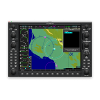
The primary map for viewing FIS-B Weather data is the Weather Data Link (FIS-B) Page in the Map Page
Group.
Viewing the Weather Data Link (FIS-B) Page:
1) Turn the large
FMS
Knob to select the Map Page Group.
2) Turn the small
FMS
Knob
to select the Weather Data Link (FIS-B, XM, or CNXT) Page.
3) If the page title displays a weather data link weather source other than ‘FIS-B’, such as ‘XM’ or ‘CNXT’, proceed
to the following steps to change the data link weather source.
4) Press the MENU Key.
5) Turn the small FMS Knob to select ‘Display FIS-B Weather’ and press the ENT Key. The page title will display
‘MAP - WEATHER DATA LINK (FIS-B)’ to indicate FIS-B is now the selected data link weather source.
On the Weather Data Link (FIS-B) page, the pilot can enable/disable the reception of FIS-B weather data,
which includes all FIS-B weather products and related softkeys on various maps.
Enabling/disabling the FIS-B weather feature:
1) Select the Weather Data Link (FIS-B) Page.
2) Press the MENU Key.
3) Turn the small FMS Knob to highlight ‘Enable FIS-B Weather’ or ‘Disable FIS-B Weather’, and press the ENT Key.
 Loading...


