7-17190-01007-03 Rev. C
GTN 725/750 Pilot’s Guide
Foreword
Getting
Started
Audio &
Xpdr Ctrl
Com/Nav
FPL
Direct-To
Proc
Charts
Wpt Info
Map
Traffic
Terrain
Weather
Nearest
Services/
Music
Utilities
System
Messages
Symbols
Appendix
Index
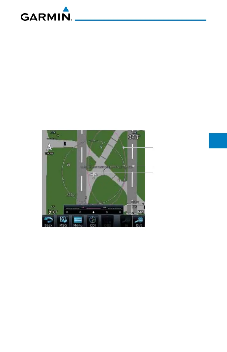
7.5.1 Using SafeTaxi
®
Any map page that displays the navigation view can also show the SafeTaxi
®
airport layout within the maximum configured range. Charts and SafeTaxi are
mutually exclusive. So, to view SafeTaxi and Hot Spots, the Charts feature must
be turned off. Charts are displayed when the aircraft is in the air, but when on
the ground, charts are removed and SafeTaxi will be shown automatically.
During ground operations the aircraft’s position is displayed in reference to
taxiways, runways, and airport features. The nose of the ownship symbol, not
the center, depicts the current location of the aircraft.
7.5.2 Hot Spot Information
Hot Spot locations are identified by a magenta circle or outline.
Hot Spot Location
Aircraft Location
Hot Spot Detail
Figure 7-26 SafeTaxi Hot Spot Depiction

 Loading...


