10-26
GTN 725/750 Pilot’s Guide
190-01007-03 Rev. C
Foreword
Getting
Started
Audio &
Xpdr Ctrl
Com/Nav
FPL
Direct-To
Proc
Charts
Wpt Info
Map
Traffic
Terrain
Weather
Nearest
Services/
Music
Utilities
System
Messages
Symbols
Appendix
Index
Selected
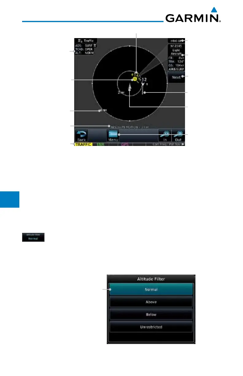
Traffic Info
ADS-B and TCAD
Status and Altitude
Filter
Traffic
Annunciation
Selected Vector
Motion and Duration
Touch For
Next Target
Map
Orientation
Ownship
Icon
Range Ring
Radius
Alerted Target,
1200 ft Above and
Climbing
Traffic Motion
Vector
Touch Icon For Info
Touch To View
Traffic Menu
Figure 10-19 Traffic Page for Ryan TCAD with GDL 88
10.6.2 Altitude Mode
The GDL 88 has four altitude display modes: Normal (±2,700 feet, Above
(-2,700 feet to +9,000 feet), Below (-9,000 feet to +2,700 feet), and Unrestricted
(±9,900 feet). The GDL 88 continues to track up to 30 intruder aircraft within its
maximum surveillance range, regardless of the altitude display mode selected.
The selected altitude display mode is displayed in the upper left-hand corner
of the Traffic page.
While viewing the Traffic page, touch the Altitude Filter
key to change the altitude volume. Select
the desired altitude
volume by touching the
BELOW, NORMAL, ABOVE, or
UNRESTRICTED keys. The selection is displayed in the Altitude
mode field.
Selected Altitude Filter
Figure 10-20 Traffic Altitude Filter Selection

 Loading...


