12-75190-01007-03 Rev. C
GTN 725/750 Pilot’s Guide
Foreword
Getting
Started
Audio &
Xpdr Ctrl
Com/Nav
FPL
Direct-To
Proc
Charts
Wpt Info
Map
Traffic
Terrain
Weather
Nearest
Services/
Music
Utilities
System
Messages
Symbols
Appendix
Index
12.6.2.3 NEXRAD Intensity
Colors are used to identify the different NEXRAD echo intensities (reflectivity)
measured in dBZ (decibels of Z). “Reflectivity” is the amount of transmitted power
returned to the radar receiver. Reflectivity (designated by the letter Z) covers a
wide range of signals (from very weak to very strong). So, a more convenient
number for calculations and comparison, a decibel (or logarithmic) scale (dBZ),
is used. The dBZ values increase as the strength of the signal returned to the
radar increases.
12.6.2.4 NEXRAD
When enabled, NEXRAD weather information is shown. Composite data
from all of the NEXRAD radar sites in the United States is shown. This data is
composed of the maximum reflectivity from the individual radar sweeps. The
display of the information is color-coded to indicate the weather level severity.
Refer to the legend for a description of the color code.
The NEXRAD option has selections of Regional, CONUS, or Combined
NEXRAD. CONUS NEXRAD includes a composite of available NEXRAD radar
imagery across the 48 states. Regional NEXRAD is a composite of available
NEXRAD radar imagery in a local area, showing a more detailed image than
CONUS NEXRAD.
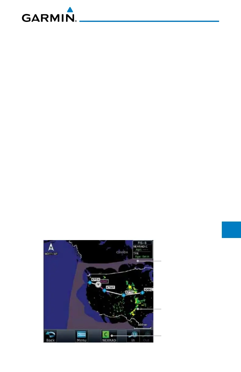
Continental US NEXRAD (CONUS)
The Display CONUS NEXRAD selection shows NEXRAD radar information
for the entire continental United States. CONUS NEXRAD data is updated every
15 minutes.
CONUS Selected
On NEXRAD Key
CONUS NEXRAD
Coverage Shown
Out Of CONUS
NEXRAD Coverage
Figure 12-92 Weather Page With CONUS Displayed

 Loading...


